|
©The Archaeological Settlements of Turkey - TAY Project
|
|
|
|
|
|
Yukari Yarimca |
|
|
For site maps and drawings please click on the picture...  |
For photographs please click on the photo... 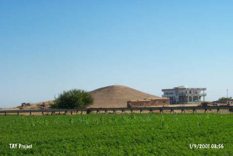 |
|
Type:
|
Mound |
|
Altitude:
|
370 m |
|
Region:
|
Southeastern Anatolia |
|
Province:
|
Sanliurfa |
|
District:
|
Harran |
|
Village:
|
Yukari Yarimca |
|
Investigation Method:
|
Survey |
|
Period:
|
|
|
|
|
 |
|
| The mound lies southeast of Sanliurfa; 8.5 km northwest of Harran; southeast of Yukari Yarimca village. It is an ovoid; conical mound with rather abrupt slopes; measuring 30 m in height and 100x60 m in diameter. The mound is discovered during the 1989 Sanliurfa Survey Project conducted by a team directed by N. Yardimci. EBA finds consist of fine wares; including metallic ware and examples with reserved-slip ornament; painted wares; and plain burnished vessels with triangular lugs. It takes place in the registered archaeological sites list prepared by Ministry of Culture and Tourism. |
| Location: |
| Geography and Environment: |
| History: |
| Research and Excavation: |
| Stratigraphy: |
| Small Finds: |
| Remains: |
| Interpretation and Dating: |