|
©The Archaeological Settlements of Turkey - TAY Project
|
|
|
|
|
|
Yogurtçubaba |
|
|
For site maps and drawings please click on the picture...  |
For photographs please click on the photo... 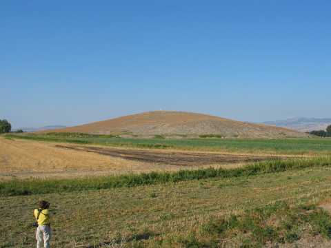 |
|
Type:
|
Mound |
|
Altitude:
|
525 m |
|
Region:
|
Black Sea |
|
Province:
|
Amasya |
|
District:
|
Suluova |
|
Village:
|
Eraslan |
|
Investigation Method:
|
Survey |
|
Period:
|
|
|
|
|
 |
|
| It lies on the southeastern slopes of the Yogurtçubaba Tepesi which is 467 m high above the sea level; 2 km south of Kulu Village of Suluova District; west of Amasya Province. It was discovered in 1987 during a survey conducted by M. Özsait and dated to the EBA. Vast majority of the pottery collected includes exteriorly grayish black and interiorly buff or red washed ware. Özsait also reports the presence of pottery bearing the characteristics of the Chalcolithic Age. It takes place in the registered archaeological sites list prepared by Ministry of Culture and Tourism. |
| Location: |
| Geography and Environment: |
| History: |
| Research and Excavation: |
| Stratigraphy: |
| Small Finds: |
| Remains: |
| Interpretation and Dating: |