|
©The Archaeological Settlements of Turkey - TAY Project
|
|
|
|
|
|
Yenice Höyük |
|
|
For site maps and drawings please click on the picture...  |
For photographs please click on the photo... 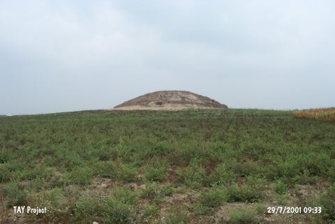 |
|
Type:
|
Mound |
|
Altitude:
|
70 m |
|
Region:
|
Mediterranean |
|
Province:
|
Adana |
|
District:
|
Karatas |
|
Village:
|
Yenice |
|
Investigation Method:
|
Survey |
|
Period:
|
|
|
|
|
 |
|
| It lies west of the motorway running from Karatas to the province; 2 km west of Yenice Village; 24 km south of Adana Province. It is a medium size mound. It measures 12 m high. It is steep on one side; and the other one has a terrace. The Cilicia Survey conducted in 1951 yielded sherds of the third and second millennia BC as well as restricted amount of sherds dating from the Hellenistic Period. Samples of the red and black burnished ware are included in EBA by M.V. Seton-Williams. |
| Location: |
| Geography and Environment: |
| History: |
| Research and Excavation: |
| Stratigraphy: |
| Small Finds: |
| Remains: |
| Interpretation and Dating: |