|
©The Archaeological Settlements of Turkey - TAY Project
|
|
|
|
|
|
Yazitarla |
|
|
For site maps and drawings please click on the picture...  |
For photographs please click on the photo... 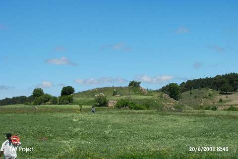 |
|
Type:
|
Mound |
|
Altitude:
|
1430 m |
|
Region:
|
Black Sea |
|
Province:
|
Ordu |
|
District:
|
Mesudiye |
|
Village:
|
Çavdar |
|
Investigation Method:
|
Survey |
|
Period:
|
|
|
|
|
 |
|
| The mound lies southwest of Ordu and of Mesudiye district; approximately 2 km southwest of Çavdar village. The mound measuring 150x100 m is located on a natural elevation just north of a stream that joins Melet stream. It is discovered in 1991 by M. Özsait. The abundance in Chalcolithic Age sherds hint the existence of an important settlement of this cultural horizon. Dark gray-black colored ware with thin-walls seems to be the dominant group of this age. Bowls and jars with vertical sides are the most common forms. EBA and Phrygian sherds consist the other finds. |
| Location: |
| Geography and Environment: |
| History: |
| Research and Excavation: |
| Stratigraphy: |
| Small Finds: |
| Remains: |
| Interpretation and Dating: |