|
©The Archaeological Settlements of Turkey - TAY Project
|
|
|
|
|
|
Bademagaci |
|
|
For site maps and drawings please click on the picture...  |
For photographs please click on the photo... 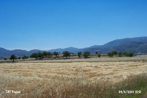 |
|
Type:
|
Mound |
|
Altitude:
|
780 m |
|
Region:
|
Mediterranean |
|
Province:
|
Antalya |
|
District:
|
Merkez |
|
Village:
|
Bademagaci |
|
Investigation Method:
|
Excavation |
|
Period:
|
EBA I EBA II |
|
|
|
 |
|
| Location: This site is in the Antalya province; about 2 km north of the village of Bademagaci. It is 50 km from the Antalya city center and 20 km from the Bucak Municipality [Duru 1995a:69] and it is located on the eastern side of the Antalya-Isparta road. |
| Geography and Environment: This mound; which used to be known as Kizilkaya; lies at the southern border of "Göller Bölgesi" (the Lakes Region) and 5 km north of the Çubuk Beli natural gorge between the Taurus Mountains and the flat Antalya Plain where the modern highway has been built [Duru 1995a: 69; 1996b: 49]. The site; surrounded by mountains on all sides; lies in a low plain. The mound is 9 m above the level of the plain and has a 210 m diameter north-south and 120 m diameter east-west. It is believed that virgin soil is 2-3 m beneath the level of the plain [Duru 1995a: 69-70;73]. The excavations are being carried out on the eastern section and the cultivated area on the west reaches this excavated part of the mound. The mound was measured 200x100 m horizontally and 7m high from the sea level in 2010 [Umurtak 2011:35]. |
| History: |
| Research and Excavation: The research conducted by R. Duru confirmed that the mound discovered in 1958 by D. French and called Kizilkaya by J. Mellaart; is in fact the site of Bademagaci [Mellaart 1961: 159][Duru 1994a: 51; footnote 11]. The excavations started in 1993 and carried out by the Department of Protohistory and Asia Minor Archaeology, IÜEF; under the direction of Duru and Umurtak, the excavation period ended in 2010. It takes place in the registered archaeological sites list prepared by Ministry of Culture and Tourism. |
| Stratigraphy: According to the ceramics found mixed with the EBA layers and two phased wall foundations uncovered at the area between the church and trench A in 2002 season; it is assumed that the latest period in Bademagaci is Middle Bronze Age. This period is followed by EBA with five occupational phases. The middle part of the mound yielded two occupational phases which are either Late Neolithic or Early Chalcolithic in date and represented only by ceramics. The earliest settlement at the site dates to the Early Neolithic Period and consists of three occupational phases [Duru 1995a:70; 1996a:87-88]; [Duru-Umurtak 2002:237;238]. There is an important change in the stratigraphy according to the 2002 season excavations. It is observed that the EBA 4 and 5 building phases are not belonging to EBA; but to a later period than Early Neolithic; probably Late Neolithic. So it is understood that the EBA settlement is consisting of 3 building phase and from now on the layers after Early Neolithic should be named as Late Neolithic [Duru-Umurtak 2004:297]. According to the statement in 2010, most of the mound except the small-nationalized area on the east, had been explored during the 18 years of excavations. The architecture of the different periods in different soundings was protected and the earliest settlement lying on the bedrock 9.30 m down from to the pick of the mound was exposed. The research indicates that the earliest settlements at the mound first occur around 7100 BC, during a period defined as Early Neolithic. This early habitation period continues through the later phases of Neolithic and Early Chalcolithic ends around 6000 BC. The secondary and last habitations on the mound belong to EBA II. Even though the architectural remains are rare, the habitation during EBA III and MBA has been recorded with pottery finds. At the highest point of the mound, there is a small church dating to Early Christianity period [Umurtak 2011:35]. |
| Small Finds: Architecture: Building level 1 yielded fragments of mudbrick walls in bad condition [Duru 1999a: draw.2] while many rectangular megarons were revealed from the building level 2 [Duru 2000: fig.3]. The entrance of those buildings on the narrow wall is right across the center of the room. Buildings 1 and 2 have a complete megaron plan. The larger one is 16 m long. The construction consists of two lines of mid-sized stones. It is suggested that the difference in the construction of the antes was started in building level 3 by extending the walls. It is also reported that between the antes of a megaron; a small building was found. R. Duru states that the megarons were placed in a radial plan so that they all face the courtyard in the middle [Duru 1998:115; Duru 1999a: fig.3]. Absence of any finds except some pottery suggests that the site had been abandoned. The building level yielded again two megarons built side by side [Duru 1998a: pic.3]. The aperture of the mudbrick building on the south of this megaron might have been a gate opening to the fields. In the building level 4; a building with a thick layer of stone and grill-shaped foundation was found. Building level 5 yielded a rectangular building [Duru 1998: pic.2]. The megaron style buildings 4 and 5 found in 1999 were identified as passage-structures because they had no exterior walls but a ceiling [Duru 2001: 98]. It is unclear if the settlement of Bademagaci was fortified. The 13 m long; thick stone wall on the northeast may have been a terrace wall or a ruined fortification. This wall is only 1 m high today. It was built in dry wall technique by big and clumsy rocks. The exterior of the wall looks clumsy because of the slipped and fallen stones [Duru 2000:pic.5]. Superstructure of the wall was presumably built of mudbrick. Therefore; it is difficult to identify it as a fortification. This type of a wall is not seen in any other part of the mound. The exterior walls of the buildings may have been used as a fortification. The exterior area of the EBA II and probably EBA III settlements has a thick pavement (Glacis) consisting of one or two layers of small and big stones. This slope pavement consists of two separate layers; each 40-50 cm thick. It is claimed that it was first built during EBA II; then renewed and repaired during EBA III. Even tough the purpose of this pavement is not well known; it is suggested that it was built to give a monumental appearance to the settlement or to prevent any erosion. During the 2001 season; it was understood that this pavement continues towards northeast. Two rooms with rectangular plans and one foundation with rounded plan were exposed in the highest section of the mound. These rounded structures; which were also observed in another trench; were probably used for storage [Duru-Umurtak 2003:323]. During the 2003 and 2004 seasons; two separate EBA settlements were investigated in the eastern and western parts of the mound. As a result of the excavations; the number of megaron-type houses belonging to levels 2 and 3 of EB II has now reached twenty-three. One of the most important problems concerning the EBA settlements not answered by the work of the 2004 season is the fact that; even though an extensive area has been excavated; it is not yet clear where the entrance to the town was situated [cat.une.edu.au/page/bademagaci%20hoyuk 2006]. The researches previously started on the northern slope during the excavations in 2005; were extended towards the north; the 'Slope Settlement (Glacis)' was partially removed and the passage - gate - that was built for entrance into the city was revealed. It was found that there was also one old; and one relatively new gate in the north part of the mound during the observation of this gate which was called 'Northwestern Gate' (Northern Gate). The excavation went 1.5 m deeper in the trench which has its narrow edge at 20 m west of the church door on the hill during the researches on the axis of the hill; in the west slope of the mound. There is a structure built with massive rocks on the edge closer to the church. An entrance/door built between the two towers/bastions of that building extending towards the end of the church was revealed. The walls that extend forward (north) on both sides of the towers were partially preserved. This structuring is the last settlement layer on this part of the mound and it dates to EBA 2nd phase. There are foundations belonging to the second settlement layer inside the trench; below that structure; approximately 50 - 70 cm underneath that settlement layer. The architectural remains of this settlement; which was found to belong to EBA 2 due to the pottery finds; extends to the westernmost tip of the trench. There is a stone pavement which is also observed on the other parts of the mound near the slope on the western edge of the trench [Duru-Umurtak 2007:642-643]. The researches in 2006 revealed that the Bademagaci EBA II settlements were entoured by megaron-like buildings. The slopes with little declinations which are at the outmost locations contained a band paved with stones (glacis) which surrounded the town in the center. The area in the center contained multi-room buildings particularly towards the south [Duru-Umurtak 2007:6-11]. Some building remains which were unearthed in the west section of the mound which is more like a profile inside the trench E; that measured 30x50 m in 2006; belonged to the single room thick wall buildings. The period that these buildings belong to were not identified. But some sherd finds belong to the late periods of the EBA II of the foundation on the remains or later [Duru-Umurtak 2008:189]. In 2007 some new rooms were revealed during the researches on the multi-room building which was excavated in the last two years on the southern and western sides of the church. At the end of the campaign a total of 17 rooms of the building complex which was founded in the area at the center of the town surrounded by the megaron houses were revealed; it was found that the building had some sub-phases and that it went through at least one major alteration but the constructors remained loyal to the original plan. There are doors to provide access between rooms [http://www.ttk.org.tr/index.php?Page=Sayfa&No=205; 2.6.2008; 15:45]. In 2008, it was proved that, Multi Room Structure dated to EBA II and partially EBA III, with 17 rooms, was expanding eastward under the church located in middle of the mound, and most probably even more further. EBA II settlement investigations at the southern slope of the mound continued and as were the other sections the presence of megaron-like buildings were revealed in this area. The buildings environed the whole settlement reached the number of 43 with the last found 11 new megarons. Excavations started at 3 separate places at the southern half of the mound beginning from just south of trench B, till the southern border of the mound. Some thick stone foundations uncovered at about 1 m depth in trench F were most probably dated to transition period from EBA II to EBA III which was the last settlement layer of EBA at the mound. Despite that any architecture was not found in trench G, there were very extensive architectural remains reached in trench H. A building group was established in here, which was similar to the Multiple Room Structure in the middle of the mound but did not directly related to it. This building group was consisting of row of rooms, not megarons [Duru-Umurtak 2010:262-264]. The trench is extended in South in 2009 and 8 new megarons are excavated, some entirely and some partially. Megarons vary in size and are organized in a radial position while their doors are opened on their narrow walls facing the centre of the mound like the other megarons which are found in the most outer circle of EBA II. A large room (cella) which must be the living room of the house is entered through the doors between antes. The houses consist of two rooms and the second room can be accessed through the door opened in the rear wall. There is a stone-paved area just behind the rear wall of the house and adjacent to it. This is the typical and non-varying order of the structure layers EBA II/1 and 2 of Bademağacı. Only one house among all has a door opened near the Western corner of the narrow wall facing out (South). There is a window opening 70 cm above the ground approximately in the middle of the narrow wall where the door is. There are 1.5 m thick walls out of both sides of the rear door of the house facing south. These strong walls are made by such great care and strength that they are not encountered anywhere else in the mound. They may be defensive walls. Since this is the only structure of the city in relation to the outside, it is defined as "Main Gate". Looking at the general plan of EBA II/1, 2 settlement it is understood that the Southern border line of the settlement is not symmetrical to the Northern margin, but rather it is more flat/squat. Especially the Western corner of the Southern margin has almost a perpendicular angle [Duru-Umurtak 2011:439-441]. During the 2010 excavations conducted throughout the thick wall extends in the north-south direction, which its function couldn't be determined in previous year, different structures with large stone walled belonging to the last phase of EBA II were discovered. The foundations formed with large stones, which could be dated to the last two phases of EBA II, have been seen on megarons arranged along the western slope as well. The architectural complex on the southern slope is dated to EBA II / the building level 3. On the south side of the settlement, some parts of the sections facing outwards are covered with irregular stones as with the other slopes. One of the interesting features is the circle formed with a row of stones on the south section. These kinds of circles, which their diameters range from 1 to 2 m, have been encountered in the middle and the north sections of the mound as well. 9 circles have been discovered so far. It was found out that only one of them was used a grave [Duru-Umurtak 2012:116-119]. Pottery: R. Duru states that there are sherds of the very well burnished; thick walled ware with a red paste in the EBA building levels. The superior building levels yielded small bowls; spouted pitchers decorated with channel and reliefs while the upper building levels revealed flat bowls with pointed rims [Duru 1996: 89] [Duru 2001: pic.8]. G. Umurtak analyzed the brownish ware in EBA II and stated that this ware was imported from another region [Umurtak 1998: 9] and this sample even went back to the first phase of EBA. Forms are similar to the group of ware with red paste. G. Umurtak published a distribution map for this ware into other EBA settlements [Umurtak 1998: 10]. The pink/reddish sherds with fast turning wheel marks are dated to EBA III or even MBA [Duru-Umurtak 2003:323]. A small beak spouted pitcher was found in one of the graves opened in 2004 [cat.une.edu.au/page/bademagaci%20hoyuk 2006]. There are many kantharos with cylindrical necks; small spouted pitchers; and flat bowls which are typical items of EBA 2 pottery were revealed during the excavations that took place in 2005 [Duru-Umurtak 2007:643]. In 2006 te single handle beak shaped spouted small and mid size jugs as well as twoı handled jugs which are the typical examples of the EBA II were unearthed in large amounts [Duru-Umurtak 2008:190]. In 2007; 28 small beak spouted jugs; basic jugs and other vessels were revealed intact or in reconstructable condition [Umurtak 2008:22-23]. The most crowded group of EBA II pottery consists of Red Ware. Typical examples of this group that were uncovered in large numbers during 2008 campaign were, handled, beak shaped spouted, small and mid size jugs and two handled jugs. During the same period also a smaller quantity of Grey and Black Ware were uncovered. These were rather thin rimmed, well burnished; mostly white incrusted or relief-decorated medium or small sized spouted pitchers and medium sized pots [Duru-Umurtak 2010.265]. Some of the pottery among many found with a variety of forms in a room during 2009 excavations are of highest quality ever found in Bademağacı EBA II settlements. Especially a dissociated vessel is very original with the clay it's made of and with its type decoration which unknown in Bademağacı and its form. This dissociated vessel is similar with its general features to the Salt and Pepper Shaker that is found in the early excavation days [Duru-Umurtak 2011:441-442]. A lot of vessels (some of them are complete) were found inside the structures belonging to different phases of EBA II and the deposit covering these structures in 2010. Vast majority of the vessels consist of bell-shaped vessels and spouted, thick and short-necked shallow vessels. Among these vessels, there are also long necked spouted pitchers and jars. Only a few of the vessels are with reliefs and incised decoration [Duru-Umurtak 2012:119]. Clay: Seal stamps [Duru 2000: pic.8]; spindle-whorls; animal figurines and idols were found. Some of the terra cotta artifacts found during the researches in 2007 were stilized human descriptions namely the idols. Some of the examples in this group are similar to the idols previously found in Bademagaci. Another handicraft is a sort of a description. This sample is circular and completely plastic; and the position of the arms and the making of the body is a first at Bademagaci. The head of the description is rather the "handle" of an object than idol [http://www.ttk.org.tr/index.php?Page=Sayfa&No=205; 2.6.2008; 15:45]. Among the terra cotta handicrafts; in addition to the idols; the number of seals with geometrical figures on their circular; quadrangular; triangular print areas is around 20 [Umurtak 2008:22-23]. In 2008 campaign 10 stamp seals were found. Those were having geometrical patterns on their round or square stamp areas. Some of those seals considered very unique with the placement of decoration on stamp areas [Duru-Umurtak 2010:266]. 16 more seals are captured similar to those captured in previous years are captured in 2009 excavations [Duru-Umurtak 2011:442]. During the 2010 excavation campaign, 20 seals were found and the print sides of the seals are round, square or oval-foot shaped. Among the baked clay finds recovered from the site, there are a few idols, a great number of spindle whorls, large beads and a plain or decorated terracotta pedestal/potstand [Duru-Umurtak 2012:120]. Ground Stone: Two blades; stone seal and earplug were recovered [Duru 1995: 72]. Plenty of rounded or heart shaped items made of limestone were found inside a building. Their functions are unknown. Metal: R. Duru reports the presence of metal finds. 2009 excavations have been very effective in terms of metal art works. Almost all of the finds have been located in two separate large pots between many found in situ on the floor of a room that is adjacent to the south wall of the house defined as Main Gate Building. 2009 metal finds include an earplug made of gold, a silver plate, two silver needles, a bronze or copper needle and perforator, a spear head and a hand axe [Duru-Umurtak 2011:442-443]. Human Remains: An infant burial was found in a pithos grave inside the building no. 9 belonging to building level II or III. No grave goods were found. |
| Remains: |
| Interpretation and Dating: All the building levels of EBA yielded megaron or megaron-like buildings in the plan of a small city or a big town. The site has a monumental appearance with its slope pavement. R. Duru states in one of his last publications that Bademagaci EBA settlement has the view of a strong castle [Duru 2000: 112]. It is surprising to see this settlement; very poor in small finds; without a surrounding fortification. It is unclear if a ruler controlling the area resided here. Culturally; it yields finds identical to Karatas Semayük in the neighboring area of Elmali. The EBA pottery; seals and idols found in the building levels 3 and 2 is compared with the ones in the Eastern Anatolia and Elmali regions. The absence of imported pottery indicates that probably the site was not involved in the trading activities. All EBA settlements lasted from the 4th Millennium BC until the midst of the 3rd Millennium BC [Duru 2000c: 62]. Significant changes were observed in EBA II; at the researches performed on the northwest slope during the excavations in 2005. The small lowland surrounded by the mountains in which the mound is located at; possibly was flooded due to the formation of ponds. The settlers of EBA surrounded the slopes of the mound with stones to keep the water flooding their houses. It was found that this stone pavement/covering work (glacis) was redone many times. In addition to the stone pavement on the slopes an approximately 1 m large wall (fortification) foundation at the external edges of the houses (megaron) at the north of the settlement was also constructed [Duru-Umurtak 2007:642]. As a result of the excavations near the church it was found that there were many large scale buildings at this section; having sturdy walls. Although the situation is yet to be cleared; the only thing that is certain; is this: Possibly there are no megaron type of buildings at this half of the mound; which were common at the trench A; at north. In other words there are no residences on this half of the mound. The sturdy wall buildings which were partially unearthed; possibly were the buildings related with the administration of the settlement [Duru-Umurtak 2007:643]. The researches in 2006 revealed that the EBA settlements of the north continued in parallel with southern settlements. The developments identified inside the Bademagaci EBA settlements; saw to it that the settlement planning is identifiable and comprehensible. There is no other settlement so big found in the western half of Anatolia; or even the whole Anatolia yet that was excavated in the dimensions of and as sturdy as Bademagaci EBA settlements. Therefore the statement "the EBA town of Bademagaci became a reference point in terms of the settlement texture and settlement logic for the entire region" may be made. Another important matter that can be added to these hypothesis; is "The EBA town of Bademagaci was planned beforehand and that plan was implemented carefully and neatly for a long period of time; an authority was present at that location; meaning this settlement was a sort of a city state or an EBA polis" which is a high probability [http://www.ttk.org.tr/index.php?Page=Sayfa&No=205; 2.6.2008; 15:45]. There are some doubts that rooms revealed during the researches on the south and west of the excavated Multi-Room Building in 2007 are related with the same building. That is due to the relation between some of the room groups. It was figured that these room groups may be related to more than one building. But due to the presence of the church in the center of the multi-room building and there is no way of removing this building to find out what lies underneath; there probably is no way of making a correct analysis of the situation. There are also obstacles in the identification of the multi-room building's function. Since identifying this building as a residential building would be incorrect it would be right to think of the building complex both as an administrative / official building; and a royal buyilding (residence). It could even be defined as a "Palace". The answers to these questions are yet to be found [http://www.ttk.org.tr/index.php?Page=Sayfa&No=205; 2.6.2008; 15:45]. There are vessels which are in typical EBA II forms as well as the ones that possibly belong to the period after EBA II among the sherds found at the Multi Room Structure during researches between 2005-2007. This situation also matches with the settlement from a chronological standpoint. In other words the various types of vessels belong to EBA III [Duru-Umurtak 2009:259]. Based on the results of the 2010 excavation campaign, it has been suggested that the middle and the southern sections of the mound were planned in complex and they had different functions in terms of architecture. Most probably the building complex with 17 rooms, which was excavated in 2007 and 2008, was the residence where the most powerful people lived. Further to the south, the structures adjacent to the outer circle of the city had different functions as well [Duru-Umurtak 2012:117]. |