|
©The Archaeological Settlements of Turkey - TAY Project
|
|
|
|
|
|
Tuglu Höyük |
|
|
For site maps and drawings please click on the picture...  |
For photographs please click on the photo... 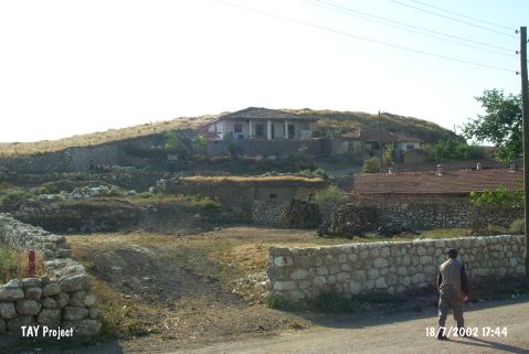 |
|
Type:
|
Mound |
|
Altitude:
|
835 m |
|
Region:
|
Central Anatolia |
|
Province:
|
Çorum |
|
District:
|
Ugurludag |
|
Village:
|
Tuglu |
|
Investigation Method:
|
Survey |
|
Period:
|
|
|
|
|
 |
|
| It is located in Tuglu Sub-District; west-southwest of Çorum Province. It has been surrounded by modern houses. It looks like a small hill. It measures 15 m in height and 75x90 in dimensions. It is also used as the cemetery of the village. It has been severely damaged by the modern buildings. Through the splitted sections; traces of walls with a limestone substructure and mudbrick superstructure can be seen. The surface collection carried out by a team under T. Sipahi and T. Yildirim in 1996 yielded sherds dating from the third; second and first millennia BC. |
| Location: |
| Geography and Environment: |
| History: |
| Research and Excavation: |
| Stratigraphy: |
| Small Finds: |
| Remains: |
| Interpretation and Dating: |