|
©The Archaeological Settlements of Turkey - TAY Project
|
|
|
|
|
|
Top Tepe |
|
|
For site maps and drawings please click on the picture...  |
For photographs please click on the photo... 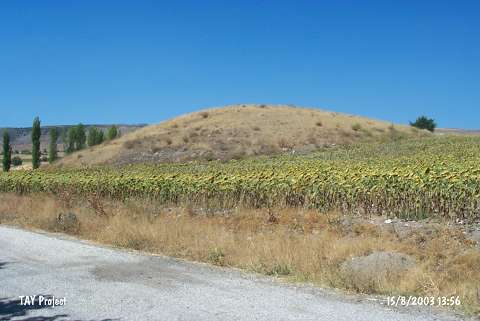 |
|
Type:
|
Mound |
|
Altitude:
|
730 m |
|
Region:
|
Black Sea |
|
Province:
|
Çorum |
|
District:
|
Merkez |
|
Village:
|
Tatar |
|
Investigation Method:
|
Survey |
|
Period:
|
|
|
|
|
 |
|
| It lies 1.5 km northeast of Tatar Village; right of the road running to village at the 3.3rd km of the exit to the north; 20th km of the Çorum-Ankara highway; southwest of Çorum Province. It is a small mound. It measures 10 m in height above the road and 75x80 m in dimensions. It was discovered in 1997 during a survey under T. Sipahi and T. Yildirim. Pottery of the EBA; the MBA; the Iron Age and the Classical Period was collected from the surface. |
| Location: |
| Geography and Environment: |
| History: |
| Research and Excavation: |
| Stratigraphy: |
| Small Finds: |
| Remains: |
| Interpretation and Dating: |