|
©The Archaeological Settlements of Turkey - TAY Project
|
|
|
|
|
|
Tepeler / Konk |
|
|
For site maps and drawings please click on the picture...  |
For photographs please click on the photo... 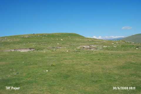 |
|
Type:
|
Mound |
|
Altitude:
|
1890 m |
|
Region:
|
Eastern Anatolia |
|
Province:
|
Ardahan |
|
District:
|
Merkez |
|
Village:
|
Tepeler |
|
Investigation Method:
|
Survey |
|
Period:
|
|
|
|
|
 |
|
| It lies west of Tepeler (Konk) Village; immediate north of the junction of the Ardahan-Göle and the Ardahan-Ardanuç motorways; 12 km southwest of Ardahan Province. Ortaçay stream flows on its western skirt. It is located on a natural hill. Its west is steep while the east is flat. There is a terrace on the north. It was discovered by K. Köroglu in 1996. Plenty of sherds dating from the EBA was recovered on the southern part [Köroglu 1998:133-134]. The illicit diggings yielded a circular building 3 m in diameter and walls being 130 m high. An almost intact jug with a simple rim bearing the typical characteristics of the Early Transcaucasian ware was found in this building [Köroglu 1998:pic.7]. Pottery and remains belonging to the Middle and Late Iron Ages were found on the other parts of the mound. There are remains of a Middle Age fortress on the western end. It was visited during the survey conducted by S. Pataci in 2013. A great number of potsherds dating to Bronze Age, IA and Middle Age were found [Pataci 2015:106]. |
| Location: |
| Geography and Environment: |
| History: |
| Research and Excavation: |
| Stratigraphy: |
| Small Finds: |
| Remains: |
| Interpretation and Dating: |