|
©The Archaeological Settlements of Turkey - TAY Project
|
|
|
|
|
|
Tell el Cüdeyde |
|
|
For site maps and drawings please click on the picture...  |
For photographs please click on the photo... 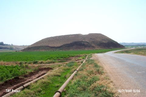 |
|
Type:
|
Mound |
|
Altitude:
|
220 m |
|
Region:
|
Mediterranean |
|
Province:
|
Hatay |
|
District:
|
Reyhanli |
|
Village:
|
Merkez |
|
Investigation Method:
|
Excavation |
|
Period:
|
Ceramic |
|
|
|
 |
|
| Location: The site lies southeast of Antakya; 1.8-1.9 km east-southeast of Reyhanli District. |
| Geography and Environment: The site is one of the biggest mounds in Amuq Plain; on which; more than 200 settlements; dating to various periods; are located due to the most recent survey. The site; surrounded by fertile lands irrigated by the branches of Afrin Stream; is convenient for settling. The mound measures 370 m in East-West axis; 250 m n North-South axis; and 31 m high above the level of the plain. A desiccated lake is located at the north. A creek; named Kizil Ark or Nahr el Cüdeyde; flows east of the mound. This creek was most probably used as a water source by the inhabitants. The site is observed to be severely damaged like the other mounds in Amuq Plain. A mudbrick wall; probably a fortification; has been revealed by a bulldozer; and is about to vanish. Amuq Plain (named incorrectly as Amuq Plain in the archaeological publications) lies east of Amanos Ranges; and covers an approximate area of 55x40 km. The plain reaches the Mediterranean on the southwestern extension. The ardent lands of Northern Syria; like deserts with low hills; lie east of Amuq Plain. Orontes and its branches not only irrigate the plain; but create fertile lands by the alluvium it accumulates. The site is more convenient in climate for settling; compared to Northern Syria. |
| History: |
| Research and Excavation: The site was discovered in 1933 during the surface survey conducted by R.J. Braidwood of the University of Chicago Oriental Institute. Excavations on the mound were begun in 1935 under Braidwood's direction. The oldest layers of the mound were reached (neolithic); was opened in the west-northwestern slope of the mound. The EBA levels were reached at trenches JK and TT20 during the excavation conducted by Braidwood covering a very restricted area. For example; Phase H of the Amuq was dug only in an area of 116 squaremeters. The extreme damage done between 1935 and 1995 has made it necessary for the Institute to initiate a second campaign of excavations. Research conducted by the Oriental Institute; Chicago was resumed in 1995 under the direction of A. Yener. In the first season; a regional surface survey was conducted and a salvage excavation was begun at Tell el Judaidah. T. Wilkinson has since been continuing archaeological and geomorphological research in the area [Yener et al. 1996a:49]. The second campaign was more like a sounding for recording the remains in the destructed area. It takes place in the registered archaeological sites list prepared by Ministry of Culture and Tourism. |
| Stratigraphy: Excavations at this mound determined that the site of Tell el Judaidah was inhabited from the Neolithic on through to historic periods. Amuq A and B phases (also known as phase XIV) were uncovered in trench JK3; beneath the water table. Strata 24 and 25 were assigned to Amuq B while 25-27 were Amuq A Ceramic Neolithic. Amuq A was exposed in a 72 square meter area. Virgin soil was reached. No Aceramic Neolithic layers were found. It is therefore presumed that Lake Antioch was much larger in this period. The Aceramic Neolithic habitation in the area must have been on the hills surrounding the plain and in the valley between the hills. |
| Small Finds: Architecture: No architectural structures were excavated in the lower levels at Tell al Judaidah because the water table was reached and the 1935 excavations continued with much difficulty. In stratum 24; assigned to Amuq B; the corner of a mudbrick rectangular or square structure with stone foundations was excavated. The 1995 survey noticed some architecture in cross-sectional profiles in the north and northeastern parts of the mound which were partially destroyed by a bulldozer. Amuq F and G ceramics were collected from this area while work on the Neolithic has not yet begun [Yener et al. 1996a:67]. Pottery: Layers 25-27 yielded Amuq A ceramics which include three main types: Coarse Simple Ware; Dark Burnished Ware; Washed and Impressed Ware. The first of these ware types is sand; mica and chaff. It has a black core and orangey-buff surface color. Some of the surfaces have been wet-smoothed while others have been roughly burnished. Oval bodied bowls are very common. The other vessel shapes include deep bowls and high necked jars with flaring mouths. Decorated vessels are rare. The second ware type; Dark Burnished Ware is also hand-made. The clay for these vessels has mica and possibly chaff temper and is a shiny brown or buff color. Most of the examples of this type of ware are well burnished. It is thin-walled and has been well-fired. Mostly high and closed vessels are made with this type clay. Collared jars; shallow jars and closed forms are also present. The third ware type; Washed and Impressed Ware; is also hand-made like the other types. This type of ware is poorly fired. Clay: Baked clay spindle whorls; disks and spool-like objects were found. Chipped Stone: Both Amuq A and B phases have the same chipped stone industry. Of the tools and debitage products; only 25% is obsidian while the rest is flint. The most common weapons are points. These points have also been called spear-heads and Byblos points. Short sickle-blades were also found. Ground Stone: Stone bowls with slightly burnished outer surfaces were found. Some of these may have been used as mortars. Some of these bowls are basin-like. In addition to stone vessels; celts; limestone weights and seals were found. Bone/Antler: Several types of awls and perforators were found. A fragment of a bone belt buckle usually found in the Aceramic Neolithic was found. |
| Remains: |
| Interpretation and Dating: The stratigraphy exposed by the Tell el Cüdeyde/Judaidah excavations provided a ceramic seriation for the entire Amuq Region and beyond. All the finds found in Braidwoods' 1933 surface survey were assessed after this seriation. Judaidah A-B finds have helped in assignment and dating of southeast Anatolian finds. |