|
©The Archaeological Settlements of Turkey - TAY Project
|
|
|
|
|
|
Davutpasa |
|
|
For site maps and drawings please click on the picture...  |
For photographs please click on the photo... 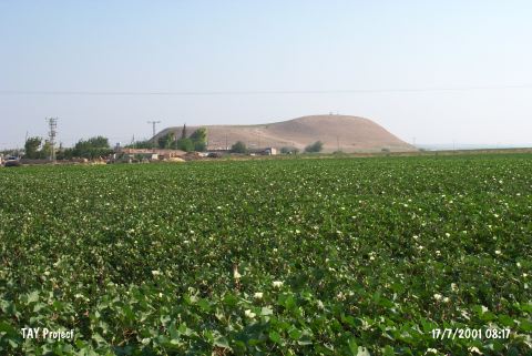 |
|
Type:
|
Mound |
|
Altitude:
|
220 m |
|
Region:
|
Mediterranean |
|
Province:
|
Hatay |
|
District:
|
Reyhanli |
|
Village:
|
Davutpasahöyügü |
|
Investigation Method:
|
Survey |
|
Period:
|
|
|
|
|
 |
|
| It lies close to Davutpasahöyügü Village; northeast of Reyhanlı District of Hatay Province. 500 m west of the mound flows Afrin Stream. It is rather big and terraced. The site was discovered by R.J. Braidwood and potsherds dated to Neolithic and EBA found. There is no detailed information abot the EBA materials. |
| Location: It lies close to the village which it was named after; 6 km northeast of Reyhanli District of Hatay Province. |
| Geography and Environment: It lies 500 m east of Afrin Stream which is one of the creeks watering Amuq Plain. The mound is rather big and terraced. |
| History: |
| Research and Excavation: |
| Stratigraphy: |
| Small Finds: |
| Remains: |
| Interpretation and Dating: |