|
©The Archaeological Settlements of Turkey - TAY Project
|
|
|
|
|
|
Tarmil Höyük |
|
|
For site maps and drawings please click on the picture...  |
For photographs please click on the photo... 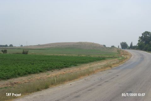 |
|
Type:
|
Mound |
|
Altitude:
|
120 m |
|
Region:
|
Mediterranean |
|
Province:
|
Adana |
|
District:
|
Kozan |
|
Village:
|
Ufacikören |
|
Investigation Method:
|
Survey |
|
Period:
|
Middle |
|
|
|
 |
|
| The mound lies 3.8 km northwest of Ufacikören Village; approximately 12.5 km southwest of Kozan District; 84 km northeast of Adana Province . The conic mound measures 25-30 m in height and has dimensions of 90x70 m. Known also by the names of Termir and Tirmir; it lies on a plain watered by Kurucuoglu stream. It is discovered during the 1936 Nielson Expedition and investigated again in 1951 during the Cilicia Survey. Coba ware sherds collected from the surface point to a possible Middle Chalcolithic Age settlement. It is as well presented as a Neolithic Age site [Harmankaya et al. 1997:Tarmil Höyük]. It takes place in the registered archaeological sites list prepared by Ministry of Culture and Tourism. |
| Location: The mound lies 3.8 km northwest of Ufacikören Village; approximately 12.5 km southwest of Kozan District; 84 km northeast of Adana Province. |
| Geography and Environment: The mound is fairly large in size. It has a 90x70 m base and is between 25 and 30 m high. It lies in a small plain fed by Kurucuoglu Stream. In some publications; the site has been called Termel or Tirmir. Southeast of the mound cemetery of the village takes place. |
| History: |
| Research and Excavation: |
| Stratigraphy: |
| Small Finds: |
| Remains: |
| Interpretation and Dating: |