|
©The Archaeological Settlements of Turkey - TAY Project
|
|
|
|
|
|
Samsin |
|
|
For site maps and drawings please click on the picture...  |
For photographs please click on the photo... 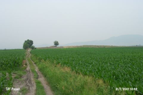 |
|
Type:
|
Mound |
|
Altitude:
|
70 m |
|
Region:
|
Mediterranean |
|
Province:
|
Osmaniye |
|
District:
|
Kadirli |
|
Village:
|
Koçyurdu |
|
Investigation Method:
|
Survey |
|
Period:
|
Middle |
|
|
|
 |
|
| The mound lies northeast of Adana; 15 km south of Kadirli district; 4 km east of the Ceyhan-Kadirli highway; on the village road to Koçyurdu (Endel) and Eskiler. Akyol runs beside the mound on the skirts of Anti-Tauruses. The ovoid; broad and shallow mound has a height of 7 m and a diameter of 50x70 m. It is discovered by M.V. Seton-Williams in 1951. The surface finds indicate settlements in Neolithic Age; Chalcolithic Age and Hittite Period. |
| Location: This site lies northeast of the city of Adana; 15 km south of the town of Kadirli; 4 km east of the Ceyhan-Kadirli highway; along the dirt road that goes to the villages of Koçyurdu (Endel) and Eskiler. |
| Geography and Environment: The mound lies along a road; on the flanks of the Anti-Taurus Mountains. It is an oval-shaped mound which is 50x70 m in diameter and 7 m high. |
| History: |
| Research and Excavation: |
| Stratigraphy: |
| Small Finds: |
| Remains: |
| Interpretation and Dating: |