|
©The Archaeological Settlements of Turkey - TAY Project
|
|
|
|
|
|
Subak |
|
|
For site maps and drawings please click on the picture...  |
For photographs please click on the photo... 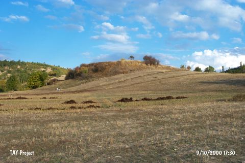 |
|
Type:
|
Mound |
|
Altitude:
|
1170 m |
|
Region:
|
Aegean |
|
Province:
|
Kütahya |
|
District:
|
Emet |
|
Village:
|
Subak |
|
Investigation Method:
|
Survey |
|
Period:
|
EBA II |
|
|
|
 |
|
| It lies 2 km west of Subak Village; east of Emet District; Kütahya Province. It measures 8.5 m in height and 100 m in diameter. It was discovered in 1992 during a survey conducted in the vicinity by T. Efe. The settlement of Classical Period covers a wide area. EBA II material was collected from the northern and western slopes. Also reported are finds dating from the Late Chalcolithic Age and the LBA. Plenty of marble idols; polished stone axes and fragment of a decorated spindle-whorl were uncovered in a field on the northern slope by the owner of the field. Marble idols are identical to the samples particularly known in the southwestern Anatolia region. They are dated to the EBA II. Slopes of the mound have been completely damaged. It takes place in the registered archaeological sites list prepared by Ministry of Culture and Tourism. |
| Location: |
| Geography and Environment: |
| History: |
| Research and Excavation: |
| Stratigraphy: |
| Small Finds: |
| Remains: |
| Interpretation and Dating: |