|
©The Archaeological Settlements of Turkey - TAY Project
|
|
|
|
|
|
Subak |
|
|
For site maps and drawings please click on the picture...  |
For photographs please click on the photo... 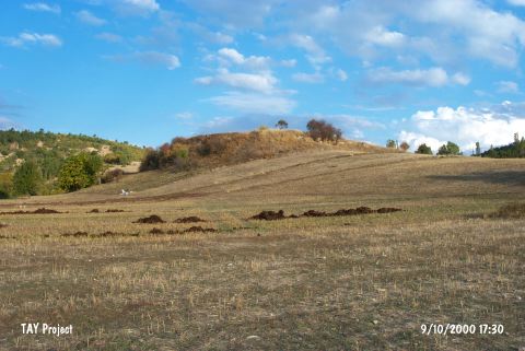 |
|
Type:
|
Mound |
|
Altitude:
|
1170 m |
|
Region:
|
Aegean |
|
Province:
|
Kütahya |
|
District:
|
Emet |
|
Village:
|
Subak |
|
Investigation Method:
|
Survey |
|
Period:
|
Late |
|
|
|
 |
|
| The mound lies west of Kütahya; east of Emet; 2 km west of Subak village; between two streams. It is 8.5 m in height and 100 m in diameter. It is discovered in the 1992 regional survey around Kütahya conducted by T. Efe. Remains of a fortification wall from late periods are traced on the surface. Besides abundant EBA 2 and EBA 3 sherds; Efe reports a sherd; white paint decorated on black; dating to Late Chalcolithic Age. The certainty of the existence of a Chalcolithic Age settlement on this mound requires further investigation. It takes place in the registered archaeological sites list prepared by Ministry of Culture and Tourism. |
| Location: |
| Geography and Environment: |
| History: |
| Research and Excavation: |
| Stratigraphy: |
| Small Finds: |
| Remains: |
| Interpretation and Dating: |