|
©The Archaeological Settlements of Turkey - TAY Project
|
|
|
|
|
|
Atalogun Tepe |
|
|
For site maps and drawings please click on the picture...  |
For photographs please click on the photo... 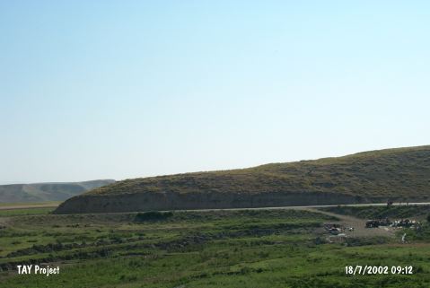 |
|
Type:
|
Mound |
|
Altitude:
|
605 m |
|
Region:
|
Central Anatolia |
|
Province:
|
Çorum |
|
District:
|
Ugurludag |
|
Village:
|
Ambarci |
|
Investigation Method:
|
Survey |
|
Period:
|
|
|
|
|
 |
|
| It stands on an hill located east of Ambarci Village; Ugurludag District; west of Çorum Province. The natural hill measures 230x130 m in dimensions. The size of the distribution of the pottery has not been reported. It was discovered in 1996 during a survey conducted by T. Sipahi and T. Yildirim in the Çorum region. Sherds dating from the third and first millennia BC and the Hellenistic Period were recovered. It can be included among the upland settlements widely seen in the region. |
| Location: |
| Geography and Environment: |
| History: |
| Research and Excavation: |
| Stratigraphy: |
| Small Finds: |
| Remains: |
| Interpretation and Dating: |