|
©The Archaeological Settlements of Turkey - TAY Project
|
|
|
|
|
|
Sirkeli |
|
|
For site maps and drawings please click on the picture...  |
For photographs please click on the photo... 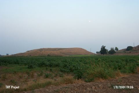 |
|
Type:
|
Mound |
|
Altitude:
|
80 m |
|
Region:
|
Mediterranean |
|
Province:
|
Adana |
|
District:
|
Ceyhan |
|
Village:
|
Sirkeli |
|
Investigation Method:
|
Excavation |
|
Period:
|
|
|
|
|
 |
|
| Location: It is situated on ancient trade routes both in east-west and in south-north directions, in Sirkeli Village of Ceyhan 40 km east of Ceyhan District in Adana [Novak et al. 2009:297]. |
| Geography and Environment: Ceyhan River that runs through Sirkeli Village, ancient Bagdat railway, the modern motorway and Middle Age Yilan Fortress point out at the importance of the location of the mound [Novak et al. 2009:297]. |
| History: |
| Research and Excavation: A sounding was carried out in 1936 by J. Garstang. Levels of the Hittite and Late Hittite Periods are reported to be thick. Another surface collection was carried out under M.V. Seton-Williams in 1951. Material collected exposes that the site had been inhabited from the Chalcolithic Age to the Roman Period. It has been reported that samples of the metallic wares dating from the EBA were also recovered during the Mellaart's survey. In Sirkeli Mound the preliminary excavations are restarted in 2006 and continued in 2007 and 2008. The excavations are carried out by Universities of Eberhard Karls Tübingen and Çanakkale Onsekiz Mart, per the collaboration agreement between the two universities by an interdisciplinary team consisting of German and Turkish members. It is found out that Sirkeli Mound is a settlement which is made up upper city, lower city and Northeast terrace during Bronze and Iron Ages [Novak-Kozal 2011: 42]. It takes place in the registered archaeological sites list prepared by Ministry of Culture and Tourism. |
| Stratigraphy: |
| Small Finds: Architecture: Beginning the 2006 excavations 2 m depth is reached in the trenches connected with the stone building in the trench in the North of slope in Field A. Intense adobe destruction is observed in this layer during the studies carried out in 2009. Many burnt timber pieces and remains of a timber stretcher are encountered in this level of destruction. Adobe bricks are very rigid and yellow, and not straw tempered. The collapse of the walls could be identified after the falling styles of adobe bricks are analysed. White lime plaster marks exist on many adobe bricks. The adobe bricks on the top row contain intense marks of fire and some have turned into red. Wall ruins are at least 1.5 m long having a slope of 45° and start from the North end of the stone building. Medium and large lime stones between the adobe-bricks which constitute the destructed founding stones of the building. These findings show that the top parts of stone walls that are 1.85 m tall are made of adobe. It is believed that the timber stretchers belong to the roof or to a possible second floor. Small drills are carried out around the stone building and it is observed that the Stone Wall M141 is built above an adobe wall at the same location with it [Novak-Kozal 2011: 43]. The analysis carried out during the previous years on surface potteries was suggestive of a pottery oven in this field. Geomagnetic measurements held in 2009 confirmed the existence of an oven and its exact point is located [Novak-Kozal 2011: 43]. Pottery: Potteries found in the destruction level of Field A of Northwest Terrace are from Late Bronze Age and mainly Middle Iron Age. It is significant that Cyprus Middle Iron Age potteries are intense here. A rim of pendent semi-circle skyphos originated from Inland Greece from Late 8th Century BC is found [Novak-Kozal 2011: 43]. The ages of pieces found in 2009 range between Early Bronze Age and Iron Age. Many non-decorated plain wares (Monochrome, Drab Ware) that belong to Late Bronze Age are worth noting. And pieces of three Miken pots are the first Aegean wares from Bronze Age in Sirkeli. One of these is originated from Argolis and is from GH IIIA Period [Novak-Kozal 2011: 44]. The 2011 excavation campaign yielded EBA pottery which represents dark faced burnished ware, coarse and plaşin wares, brittle orange, red streak burnished ware, wares with incised decoration and metallic ware. The most common types are bowls, cooking and storage pots [Novak-Kozal 2013:416]. |
| Remains: |
| Interpretation and Dating: During the excavation in Field A and the survey carried out on Lower City it is observed that Middle age potteries from Iron Age are very intense at this site. This suggests that heavy construction activities and destructions occurred at the same time during this period. The time the stone structure in Field A which is destructed during Middle Iron Age is not yet identified. The structure is filled with thick layer of embankment which belongs to Middle Iron Age and which sets its date of destruction. Partially protected finding groups from Late Bronze Age and under the embankment and the Early Iron Age wares found within the embankment show that the structure was used from late Bronze Age until Middle Iron Age. From an architectural standing point, it is obvious that the structure has undergone many repairs and additions during many periods. This structure has survived multiple periods and since its walls are enforced with many additions it is possible that it was a city wall. The wall shifted towards North and collapsed due to erosion. And looking at the ground level where the stones fell from the base to the North slope, it is evident that the North slope was very steep during Late Bronze Age. All of these findings suggest that this structure was functioning as a defence against erosion and possible attacks from the North slope which sets the North boundary of the city. This may explain why the structure is used for so long with so many repairs [Novak-Kozal 2011: 45]. The excavations conducted in Sirkeli Mound indicate that the settlement was in contact with different regions of Anatolia, Syria, Mesopotamia and Cyprus during Bronze and Iron Age. The fact that LBA wares showing Central Anatolian characteristics and MBA wares bearing both Cyprus and Assyrian characteristics points interzonal relations. The findings recovered from the settlement indicate that the settlement shares the similar culture with Mersin-Yumuktepe, Mersin-Soli, Tarsus-Gözlükule, Tatarlı Höyük and Kinet Höyük which represent Plain Cilicia cultures [Novak-Kozal 2013: 417]. |