|
©The Archaeological Settlements of Turkey - TAY Project
|
|
|
|
|
|
Selçikler |
|
|
For site maps and drawings please click on the picture...  |
For photographs please click on the photo... 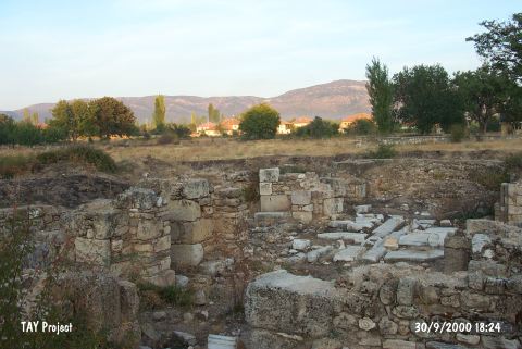 |
|
Type:
|
Mound |
|
Altitude:
|
830 m |
|
Region:
|
Aegean |
|
Province:
|
Usak |
|
District:
|
Sivasli |
|
Village:
|
Selçikler |
|
Investigation Method:
|
Excavation |
|
Period:
|
|
|
|
|
 |
|
| It lies on the Selçikler-Tatarlar road where the Tepe Quarter of Selçikler Village is located; 2 km southwest of Sivasli District; southeast of Usak Province. To the south flows the Asagi Çayir Stream. It is partially covered with the cemetery of the municipality. It was excavated in 1966 by U. Esin who has not published the excavation results in detail. The excavation was carried out by two trenches. In the upper layers; the EBA and Chalcolithic Age levels were uncovered under the buildings dating from the Byzantine Period. Three architectural levels were found belonging to the EBA. Presence of a fourth level is suggested. EBA levels have been destroyed by the levels of the Byzantine Period. It is reported that remains of walls; pottery and animal bones belonging to EBA were uncovered. Pottery of this period is black or red washed and burnished. Some bear incised and channeled decorations. Forms of three footed vessels; spouted pitchers and white painting decorated jugs are common. Also found is a polished flat stone axe. J. Mellaart showed the site as EBA II settlements map and named as Sivasli. It takes place in the registered archaeological sites list prepared by Ministry of Culture and Tourism. |
| Location: |
| Geography and Environment: |
| History: |
| Research and Excavation: |
| Stratigraphy: |
| Small Finds: |
| Remains: |
| Interpretation and Dating: |