|
©The Archaeological Settlements of Turkey - TAY Project
|
|
|
|
|
|
Samanköy |
|
|
For site maps and drawings please click on the picture...  |
For photographs please click on the photo... 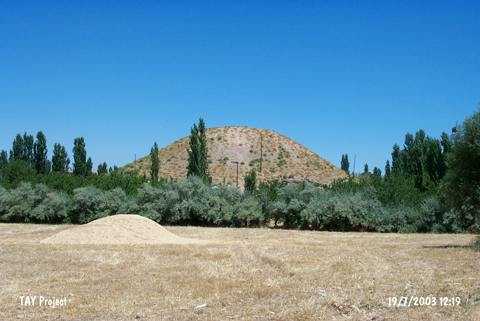 |
|
Type:
|
Mound |
|
Altitude:
|
860 m |
|
Region:
|
Eastern Anatolia |
|
Province:
|
Malatya |
|
District:
|
Merkez |
|
Village:
|
Samanköy |
|
Investigation Method:
|
Survey |
|
Period:
|
Middle |
|
|
|
 |
|
| The mound is located northwest of Malatya; approximately 1.1 km south of Samanköy Village. There are trees around the mound and the dirt road to Bahçeköy Village passes on west-northwest skirt. The 20 m high mound with a diameter of 75 m is surveyed by C.A. Burney in 1956. Russell has analyzed the chaff-faced ware sherds; made on the slow wheel; which are considered contemporary with Ubaid wares. On the other hand; Burney does not include the site among the Chalcolithic Age settlements; therefore it is one of the debatable sites for Middle Chalcolithic Age. It takes place in the registered archaeological sites list prepared by Ministry of Culture and Tourism. |
| Location: |
| Geography and Environment: |
| History: |
| Research and Excavation: |
| Stratigraphy: |
| Small Finds: |
| Remains: |
| Interpretation and Dating: |