|
©The Archaeological Settlements of Turkey - TAY Project
|
|
|
|
|
|
Salahan Mevkii |
|
|
For site maps and drawings please click on the picture... 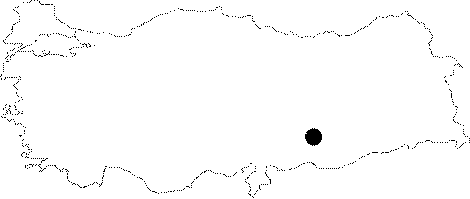 |
For photographs please click on the photo...  |
|
Type:
|
Habitation Site / Workshop |
|
Altitude:
|
m |
|
Region:
|
Southeastern Anatolia |
|
Province:
|
Adiyaman |
|
District:
|
Samsat |
|
Village:
|
Biriman |
|
Investigation Method:
|
Survey |
|
Period:
|
ÜP |
|
|
|
 |
|
| Location: This site lies on a low ridge southeast of the city of Adiyaman; about 5 km north-northeast of the town of Samsat and 1.200 m southwest of the village of Biriman; on the eastern bank of the Bolunca Stream. Its survey code is T 51 / 20. |
| Geography and Environment: A scatter of chipped stone tools were found on a Medieval site measuring 70x40 m. It is believed that the number of Palaeolithic sites will increase if surveys become more systematic. |
| History: |
| Research and Excavation: Salahan Mevkii was discovered by Özdogan during his 1977 survey in the Lower Euphrates Basin of sites expected to be flooded by the dam lake. |
| Stratigraphy: |
| Small Finds: The site yielded tools; with old patinas; comprised mostly of large flakes. Some of these flakes might have been used as end scrapers. Özdogan assigns these flakes and scrapers to the Upper Palaeolithic Period. |
| Remains: |
| Interpretation and Dating: |