|
©The Archaeological Settlements of Turkey - TAY Project
|
|
|
|
|
|
S 63/12 |
|
|
For site maps and drawings please click on the picture...  |
For photographs please click on the photo... 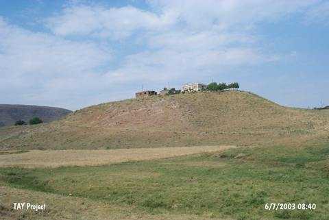 |
|
Type:
|
Mound |
|
Altitude:
|
955 m |
|
Region:
|
Southeastern Anatolia |
|
Province:
|
Siirt |
|
District:
|
Kurtalan |
|
Village:
|
Gürgöze |
|
Investigation Method:
|
Survey |
|
Period:
|
Early Middle |
|
|
|
 |
|
| The mound lies within Siirt province; 2.5 km west of Kurtalan; approximately 75 m east of Görgüze (Aynik) village; beside the Batman-Kurtalan highway. To the north is the Batman-Kurtalan motorway and to the northeast Gri Miri takes place. A stream flows from the east-southeast and the mound slopes in steps towards it. The 5 m high mound with a diameter of approximately 50 m is discovered during the 1963 survey conducted by the University of Istanbul and Chicago Oriental Institute. The earliest level dates to Pre-Halaf Period and the other finds belong to Halaf Period; Halaf-Ubaid Transition Period; Ubaid Period; end of the 4th Millennium BC; 2nd Millennium BC; Byzantine and Islamic periods. |
| Location: |
| Geography and Environment: |
| History: |
| Research and Excavation: |
| Stratigraphy: |
| Small Finds: |
| Remains: |
| Interpretation and Dating: |