|
©The Archaeological Settlements of Turkey - TAY Project
|
|
|
|
|
|
Pilav Tepesi |
|
|
For site maps and drawings please click on the picture...  |
For photographs please click on the photo... 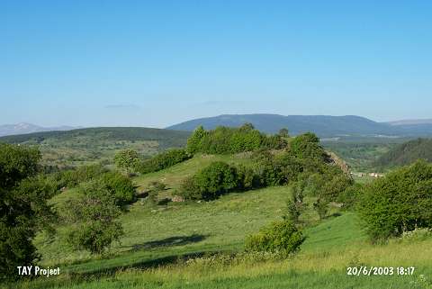 |
|
Type:
|
Mound |
|
Altitude:
|
1480 m |
|
Region:
|
Black Sea |
|
Province:
|
Ordu |
|
District:
|
Mesudiye |
|
Village:
|
Dayili |
|
Investigation Method:
|
Survey |
|
Period:
|
|
|
|
|
 |
|
| It lies 1 km northeast of Dayili Village; 15 km southwest of Mesudiye District; south of Ordu Province. It stands on a rocky ridge. To the southeast flows the Baldiran Stream. It was discovered during the 1991 Ordu-Mesudiye survey conducted by M. Özsait. Pottery of the EBA and the Phrygian Period was collected from the surface. It has been partially damaged. Exteriorly and interiorly reddish brown washed EBA pottery with a fine sand and plant tempered and light colored paste was recovered. |
| Location: |
| Geography and Environment: |
| History: |
| Research and Excavation: |
| Stratigraphy: |
| Small Finds: |
| Remains: |
| Interpretation and Dating: |