|
©The Archaeological Settlements of Turkey - TAY Project
|
|
|
|
|
|
Asagi Pinar |
|
|
For site maps and drawings please click on the picture...  |
For photographs please click on the photo... 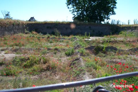 |
|
Type:
|
Mound |
|
Altitude:
|
130 m |
|
Region:
|
Marmara |
|
Province:
|
Kirklareli |
|
District:
|
Merkez |
|
Village:
|
Merkez |
|
Investigation Method:
|
Excavation |
|
Period:
|
Ceramic |
|
|
|
 |
|
| Location: The site lies south of the city of Kirklareli; on east side of Asibeyli village road; across the slaughterhouse of the town. It was discovered during the survey around Thrace and Marmara Region conducted by M. Özdogan; and published as Salhane in 1980. The mound is also cited as Kirklareli Höyügü in some publications [Özdogan et al. 1997b:53]. |
| Geography and Environment: Haydardere Stream runs through the north and west of the site. A spring with a strong flow rate is located at the west. The upper levels were probably destroyed by a tumulus that was built on top of the mound in the Late Antiquity. 40 cm thick; plastered enclosure wall; measuring 38 m in diameter and consisting of wood stakes; was built to prevent the soil erosion. The necessary soil for the construction of the tumulus was probably taken from the lower parts of the mound. Loamless soil was brought from other sources. It is interpreted that this tumulus was flattened for its valuable grave goods by the Russians invading Kirklareli in the Late 19th century. Finds; dating back from the Late Neolithic Age to the 4th century BC according to the Balkan chronology; were found at the site. This shows that the mound was medium in size before the tumulus was built [Özdogan-Parzinger 1995:51]. The excavation area is bordered with barb wire and the local house models built during the excavations can still be seen on the site. The new trenches are covered with wooden beams for protection. |
| History: |
| Research and Excavation: The archaeological sites in Kirklareli are in danger because of the rapid urbanization. The excavation of Asagi Pinar is conducted by M. Özdogan and H. Parzinger since 1993. It is reported that an area of 2000 m squares was dug at the site according to the results of 1997 excavation. |
| Stratigraphy: 7 cultural layers; which represent a thousand year period between 5200-4200 BC; were determined in Asagi Pinar. The earlist layer is dated to the Neolithic Period. The 7th layer possibly representing the first settlement in the mound is below the 6th layer which is identified in terms of the architectural and pottery groups. This layer only identified by a ditch in SE-NW direction; is interesting in terms of showing the borders of the Neolithic Age setllement. The Asagi Pinar mound is; like many other settlements in the Balkans; a mound that is displaced over time. According to this; the first settlement namely the Neolithic Age layers were actually located further north; then enlarged with the Chalcolithic Age the mound was displaced in south direction. The ditch with the carefully made clay plaster surface was partially damaged due to the mud and other items falling from the top; is still in a good condition. The ditch that was revealed in 1996; delimits the area where Neolithic Age embankments are found from the south direction. Therefore it is possible to state that the pitch surrounds the oldest settlement at this location from the south [Özdogan (E) et al. 2007:258]. The embankment found deep inside the trenches in the south of the Neolithic Age building remains south of the pitch; reflects a transition kind multi-phase period [Özdogan (E) et al. 2007:258]. During the excavations in 2006 it was found that the building level 6 was dated to 5800-5700 BC based on the 14C measurements. The group of finds within this level is similar to the contemporary Karanovo II examples from Bulgaria. On the other hand unlike the settlement in Bulgaria; the settlement plan within this building level is completely similar to the settlement plan of Ilipinar near Iznik region [Özdogan (E) et al. 2008: 39-58]. The findings in 2006 show that there are nine levels inside the mound; that were dated to the Mid/Neolithic period according to the Southeastern Europe chronology; and to Mid Neolithic and Early/Mid Chalcolithic Period according to Anatolian chronology [Özdogan (E) - Schwarzberg 2008:21-22]. The 2007 campaign unveiled the fact about the displacement of the Neolithic period settlement on the north section slightly towards the south during Chalcolithic Age and that it continued its development in that direction [Özdogan et al. 2009:234]. Stratification on the mound: Neolithic Period (8th-6th levels; 6400-5700 BC) Transition Period (Neolithic-Chalcolithic Transition) Chalcolithic Period (5th-1st levels 5500-4800 BC) [Özdogan et al. 2009:233]. |
| Small Finds: Architecture: The Neolithic layer has yielded a big structure which underwent a massive fire. It measures about 16x8 meters. Big wooden posts were used for the construction of these walls; the areas between them were weaved with thin branches like a basket and later filled with mud brick. The structure has three rooms and the partition walls were also made with the same technique but thinner. A small room surrounded by mud brick was found south of the west room. In the other rooms; there are rectangular or rounded granaries made of plastered mud brick. A large platform was encountered in the south part of the east room. To the south of this platform; a big hearth and a bench with lots of grainaries were found. According to its finds; this building was dated to the Karanova II period of the Neolithic. During 2005 season; excavations centered on the northern area; where the Neolithic layers located; especially the trenches containing Layer 6 deposits were excavated. In this layer a building complex with three adjoining rooms was uncovered in previous seasons. This years excavations cleared that the complex was extending west without interruption and the finds were similar. Lots of hearths; working places and silo-like building remains found at this area [Özdoğan-Schwarzberg 2006:15]. In order to see the building remains' borders and to make sure the stucture is a building complex consisting of adjacent rooms the excavations got deeper during the 2005 researches. As a result of the researches at this area it was determined that the embankment of the building went along the trenches opened in the west direction. This situation show that the residences in the 6th layer are adjacent and in east-west direction [Özdogan (E) 2007:258]. The researches of 2006 were performed inside the area named 'northern excavation area' in the north of the mound. The building level 7 which was opened within a delimited area; where no radiocarbon dating was performed; was represented by a ditch which is assumed to surround the settlement and not the remains. The level 6 demonstrates a circular plan consisting at least of 13 rooms inside the unearthed area. This building is very rich in terms of building elements. Almost all rooms contain a furnace. Some rooms contain over ten silos which constituted groups in certain areas; and some contain only a few silos [Özdoğan (E) et al. 2008:42-45]. The researches were performed in the north section of the mound in 2007. There is a three phase Neolithic period embankment underneath the Chalcolithic and Transition period levels which started to become unidentifiable towards the north. The oldest one of these levels was named level 8 after a series of trenches opened in 2006. This embankment consists of large and small stones; which constitute a building which may be identifiable as a cottage. The presence of buildings made of straws plastered by mortar inside the level 7 was observed [Özdoğan (E) - Schwarzberg 2008:21-22]. During the 2007 campaign performed by M. Özdogan et al. the most identifiable building inside the building level 7 was the ditch that surrounded the settlement in south direction. The ditch could be traced in east-west direction for approximately 30 m long and only an 8 m portion of the ditch was unearthed. The inside width of the ditch that was dug inside virgin soil is 2 m at the widest spot and it is approximately 1 m deep. It was filled inside with burnt adobe rubble probably dated to level 7. It is assumed that level 7 was seriously destroyed by the level 6 architecture, it was even partially leveled and mixed. Level 6 architecture on the other hand was well preserved on a widespread area. The building groups lined in east-west direction are rectangular planned with wattle and daub. The architecture was planned considering both the building technique and the plan characteristics and it points out at a planned settlement system. The rooms apparently went through a furious fire disaster. These rooms contained furnaces with adjacent platforms and silo groups in the same area [Özdogan et al. 2009:236-238]. The 2008 excavations at level 6 which is the uppermost level, were terminated. As a result of these excavations there is a series of structures in east-west direction consisting of seven rooms that were dated to 6th Millennium BC's second quarter. The structures were built in a specific form but do not have any standart dimensions or location. The room dimensions differ between 30-65 m2 and all together were placed to form a crescent, with the larger curve against north direction. The structures were heavily destroyed by the pits formed during Chalcolithic or Iron Ages, and visible throughout the whole mound. 2008 excavations suggested that this series of structures were also destroyed by the wall ditch that belongs to a level named "transition period from level 5 to level 6" [Özdoğan (E) et al. 2010:360-361]. Level 8 deposit was encountered during excavations performed in the north of level 6 and underneath the series of structures [Özdoğan (E) et al. 2010:361]. Pottery: A few red painted sherds on white background were encountered. In the deep sounding; painted Karanova and a little number of Fikirtepe ceramics were found. The 6th layer pottery found during the excavations in 2005; unlike the pottery found in the Chalcolithic layers; were painted in different tones of red color and sometimes they were painted in white [Özdogan (E) et al. 2007:258]. The pottery found inside the embankment which represents the multi-phase transition period between the 6th layer dating to Neolithic Age and the 5th layer dating to Chalcolithic Age has the similar characteristics of the pottery found inside both the Neolithic and the Chalcolithic Age layers in terms of ornamentation; style; and ware group [Özdogan (E) et al. 2007:258]. In 2006 the researches performed in the north of the mound revealed light brown; and grey ceramic ware in simple forms. It was observed that this group of ware was similar to the group of ware found during the survey right above in 1997 [Özdoğan (E) et al. 2008:42]. The ceramics revealed inside the level 6 generally display the characteristics of the Karanovo II period. The majority of these objects are coated in red and light brown. Darker ceramics are observed in the tones of grey which is less frequent. Most of the vessels were made elaborately. The mid-large and small size vessels were made in s profile spheric or semi-spheric in general; and as short neck jugs from time to time. There are also bowls with large rims; and plates. The tulip shaped vessels and single handle cups which are typical to Karanovo II are less frequent. The handles and knob handles are rare. The bottoms are usually flat and they contain wickerwork from time to time. Bell bottoms are rare. Some matched closures were also found. Ornamentation was not practiced widespread. There are very few bowls decorated in white; even less (only two piece) black and some with both. In addition to the paint there are incision and puncture decorated vessels [Özdogan (E) et al. 2008:45-46]. The ceramics revealed in the north section of the building level 8 in 2007 are in different tones of brown; dark color and most of the time burnished. This earthenware group which is thin walled; has an S profile; and outwarded thin rims; reflects more of an Anatolian impression than the Balkan cultures which it is colosely in relation with. The ceramics here is similar to the dark color ware which is commonly found in the Middle Phases of Anatolian Mid Neolithic Period and it represents the first phases of the Neolithic expansion from Anatolia to the Balkans [Özdoğan (E) - Schwarzberg 2008:21-22]. The 2007 campaign performed by M. Özdogan et al. material that represents the culture group named Karanovo I-II, well known in a large region in the Balkans and dated approximately to 6000-5700 in levels 7 and 6 were encountered. These are mostly white painted red and light brown slipped elaborately made fine ware. The white paint decoration is typical both to the period and the settlement. The white paint was mostly used for line decorations and so was the black paint from time to time [Özdogan 2009:236-237]. A well known Anatolian dark surface assemblage was encountered inside level 8 deposit in 2008. This suggests that the oldest settlement of the mound is related more with Anatolia than it is with the Balkans [Özdoğan (E) et al. 2010:362]. Clay: Numerous terra cotta loomwheights were recovered. |
| Remains: |
| Interpretation and Dating: That uneven row of structures having an almost concave form facing north with an angle close to a radius; found inside the 6th layer; is clearly different compared to Chalcolithic layers in terms of pottery. Unlike the Chalcolithic layer buildings which were constructed in separate but regular rows the fact that the settlement consists of adjacent buildings at this period may be observed as a reflection of the life styles [Özdogan (E) et al. 2007:257]. The pottery found inside the 6th layer show the similar characteristics of the First Neolithic cultures of Central and Western Balkans. But the presence of the items similar to the finds well known in Anatolian settlements became obvious [Özdogan (E) et al. 2007:258]. The transition level which shows both Neolithic and Chalcolithic Period characteristics represents both periods due to the characteristics of the ceramics [Özdoğan (E) et al. 2007:258]. The assemblage in the mound suggests that the first settlement of the mound that belongs to late 7th Millennium BC is related to Anatolia. Levels 7 and 6 that were dated to Early 6th Millennium BC were described well in terms of architecture and assemblage, and the revealed finds suggest that the Anatolian influence at the settlement was transformed to a lifestyle specific to Balkans, and the settlement was within the influence area known as Karanovo of Bulgaria. The wattle and daub architecture and red assemblage with white paint decoration inside these levels are samples in parallel to the ones found at Karanovo I and Karanovo II phases. Karanovo influence on the settlement continued approximately one thousand years parallel to Karanovo II-III, III and IV phases, and the stratification continues without interruptions. There is one cultural disconnect towards the middle of 6th Millennium BC. This cultural disconnect can be observed especially on pottery throughout the Balkans. The white painted red assemblage is replaced by burnished dark assemblage. This transformation in the mound starts with a level named "5-6 transition phase" and becomes entirely dominant after levels 5-1[Özdoğan (E) et al. 2010:358-359]. |