|
©The Archaeological Settlements of Turkey - TAY Project
|
|
|
|
|
|
Pendik - Temenye |
|
|
For site maps and drawings please click on the picture... 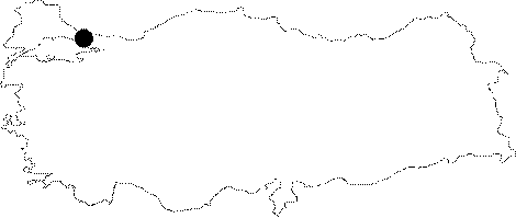 |
For photographs please click on the photo... 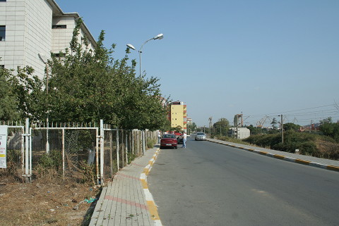 |
|
Type:
|
Mound |
|
Altitude:
|
50 m |
|
Region:
|
Marmara |
|
Province:
|
Istanbul |
|
District:
|
Pendik |
|
Village:
|
|
|
Investigation Method:
|
Excavation |
|
Period:
|
Ceramic |
|
|
|
 |
|
| Location: The site is located in the Istanbul Province; 1.5 km east of Pendik; once a village; now a district of the city of Istanbul. The mound lies between the Pendik and Kaynarca train stations; 1;450 m from Pendik Train Station and 550 m from Kaynarca Train Station. It is now beneath the gardens of the Borusan Factory and the SSK Hospital. It is possible to reach the mound by walking from the train stations or by taking the turn off to the road leading to the SSK Hospital from the Pendik-Kaynarca highway. |
| Geography and Environment: The site lies on the shore of the Marmara Sea; northwest of a small bay that lies east of the point of the Temenye Peninsula. East of the site are two springs as well as a dried stream bed. The stream must have flowed by the site in the Neolithic. The mound is protected from harsh northern winds by the hills (Göztepe and Tavsantepe) to its north. It is broad and oval in shape and 170x280 m in size. Although the site has been named Pendik Höyük after the closest village; the name Temenye Höyük is more correct. The Pendik/Temenye mound has been divided into two by the old train tracks. The press called the mound "The mound with a train going through it". From the cross-sectional profile exposed by the train tracks; the height of the mound appears to be at least 2 m. Another profile was created after the foundation of the SSK Hospital was dug. The construction of the Borusan Factory further destroyed especially the southwestern side of the site. Recently; as the city of Istanbul grew; the remaining parts of the mound became completely destroyed. On the site there are now cooperative housing structures; and more hospital buildings. The only areas where excavation could now be conducted are the Borusan Factory football fields and another area in the western part of the site. |
| History: |
| Research and Excavation: The site was discovered in 1908 by Miliopulos. Arne published the finds which he collected from the surface of the site and brought to the Stockholm National Museum [Arne 1922:122-128]. These finds were republished in 1925 by Janse [Janse 1925:166-171]. The first scientific excavation conducted on the mound was comprised of four deep soundings dug under S.A. Kansu's direction in the area dug for the train tracks. The excavation allowed the conclusion that the site is contemporaneous with the site of Fikirtepe; also in the Marmara region. The stratigraphy of the mound was not determined by this deep sounding. When the foundations of 3 large apartment buildings for a corporate housing project were begun in 1981; the Istanbul Archaeological Museum and the University of Istanbul; Department of Prehistoric Archaeology began a salvage excavation at the site with the financial support of the General Directorate of Monuments and Museums. Another excavation directed by the Istanbul Archaeological Museum was begun in 1992; south of the area of the previous excavations; west of the SSK Hospital and by the railroad because another corporate housing structure was granted building permission [Pasinli et al.1994:147-163]. It takes place in the registered archaeological sites list prepared by Ministry of Culture and Tourism. |
| Stratigraphy: The stratigraphy of layers exposed in 1981 is different than those in the 1992 excavations. Both excavations reached a yellowish red; clayey virgin soil layer void of archaeological finds. The 1981 excavations: 1- The uppermost level was a 20 cm deep surface layer with Classical and Byzantine ceramics. 2- Beneath this is a 60-80 cm deep Byzantine level. 3-The lowest level dates to the Late Neolithic and is comprised of 6 occupational phases. The 1992 excavations: The uppermost layer dates to the Classical Period; beneath this is a badly eroded layer which is represented by a few graves and some architectural remains; the lowest level is a Late Neolithic-Early Chalcolithic layer which is comprised of as few as three and as many as 6 occupational phases [Pasinli et al. 1994:152]. |
| Small Finds: Architecture: The architectural remains yielded in both excavations are almost the same. The earliest houses were built directly into the virgin soil. The houses are scattered around the site and no plan appears to have been used in their construction. The structures vary between 1 and 5.5 m in size and were sunken into the ground 50-80 cm beneath surface level. Houses are oval or circular in shape [Harmankaya 1983:27-28]. Some of the structures which were between 4-6 m in size were not sunken into the ground [Pasinli et al. 1994:149]. The houses were built on to large round depressions which were dug and then lined with large and small stones and wood. In some cases; the wood has been plastered. Holes were dug for large wooden posts. The posts are believed to have come together at the top (somewhat like a teepee). This wooden structural "cage" was covered with thin branches and twigs and then plastered both on the inner and outer sides. The plaster functioned as an insulation for the house. The only evidence remaining of these structures were the post holes and the surrounding support stones. There must also have been an opening in the roof of the wattle and daub house to emit smoke. No conclusions were reached as to the function of a number of 10-15 cm thick and 25 cm high parallel terraces which were discovered in the 1992 excavations [Pasinli et al. 1994:150]. These may have been constructed as walls between houses and/or workshops. Both excavations yielded stone lined open areas; believed to have been used for a variety of functions. The stones were plastered. Trash pits; hearths and simple ovens were also frequently found at the site. Pottery: The ceramics which; in general; are coarse do include a few examples of fine ware. The fine ware has been well-burnished and finished. It is sand-tempered. Some organic tempering has also been used. The paste is thin; almost fine. It has been partially well fired. The most common colors include dark brown and dark lead color; although faded red and buff and black surface colors can also be found. Some of the ceramics have shallow incised decoration. Impressed decoration; punctuated decoration and excised decoration are present. The decoration mostly consists of ray-like straight lines. Triangular and square designs; string and steps motifs; dot patterns and stylized suns are the common decorative motifs. The triangles and squares have been filled with straight lines. Box-shaped vessels and footed vessels such as goblets; chalices and fruit stands have also been decorated. One sherd with painted decoration was found. "S" shaped and closed vessels are very common. A few vertical tubular lugs have also been found. The pottery is characteristically similar to Fikirtepe ware. Clay: At the site of Pendik/Temenye; one woman figurine; animal figurines and a stemmed stamp seal-like object; weights and other baked clay finds were found [Pasinli 1994:fig 17-18]. Chipped Stone: Most of the chipped stone finds from this site are flint; although obsidian finds are present as well. Thin; parallel-sided blades dominate. A few perforators; end; side and rounded scrapers and points were found. There are only a small number of cores. At Pendik; like at other contemporaneous sites; the chipped stone industry follows the Epipalaeolithic industries. Ground Stone: Grinding stones; rounded hammering stones; burnishing stones and celts were found. The number of ground stone tools are few. Bone/Antler: Burnishing tools; chisels; spatulas; spoons; fish hooks and awls are the best examples of this industry. The awls suggest that leather working was a well practiced craft at this Neolithic site. Human Remains: The 1981 excavations yielded flexed burials beneath huts A and B [Harmankaya 1983:28; fig 3]. No burial gifts were recovered. The 1992 excavations yielded a total of 30 burials. 19 of these were adults; 7 were children and the rest were skeletons of fetuses. All skeletons including the fetuses were buried in flexed position. The orientations of the burials differ. Beads and bone tools were offered as burial gifts. The skeletons have not yet been osteologically analyzed. Fauna: The faunal remains from the site have not been analyzed. The fauna at this site probably resembles the Pendik fauna where analysis determined that sheep; goats and cattle were domesticated. |
| Remains: |
| Interpretation and Dating: The trench opened very close to the train tracks in the 1992 excavation yielded a very thin Neolithic layer. It has thus been concluded that the Neolithic settlement does not extend to the east beyond the western part of the SSK Hospital structures. The site was probably bounded by the stream to its east. The Neolithic site appears to have continued down the steep sloping bank of the stream. The fact that chipped stone tools and ceramics were found in the garden of the Borusan Factory suggests that the site may continue to the south as far as the Marmara Sea. The small bay in the southeastern part of the mound may have been used as a harbor for the boats of the fishermen of this fishing/hunting village. 14C dating of the wood recovered in the Pendik excavations was not determined (For 14C dates of this period; see Ilipinar). The ceramic similarities; however; allows for a placement of this site into the second half of the sixth millennium BC. Socio-economically; the inhabitants of this site cultivated wheat and other grains and domesticated herding animals in addition to hunting; gathering and fishing. The settlement is not a seasonal temporary camping site but a permanent habitation area. The site is among the oldest Ceramic Neolithic sites in northwestern Anatolia; together with the sites of Fikirtepe; Erenköy; Tuzla; Iznik Ovasi and even Göztepe. |