|
©The Archaeological Settlements of Turkey - TAY Project
|
|
|
|
|
|
Patnos |
|
|
For site maps and drawings please click on the picture...  |
For photographs please click on the photo... 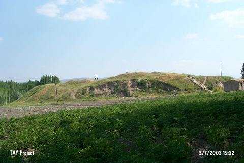 |
|
Type:
|
Mound |
|
Altitude:
|
1640 m |
|
Region:
|
Eastern Anatolia |
|
Province:
|
Agri |
|
District:
|
Patnos |
|
Village:
|
Merkez |
|
Investigation Method:
|
Survey |
|
Period:
|
|
|
|
|
 |
|
| It is located 1.5 km southeast of the municipality building in the city center of the district of Patnos; province of Agri. A tributary of Bahtisan River flows from the southeast of it. The settlement was discovered by K. Kökten and dated to the EBA. It is also known as Giriktepe. It takes place in the registered archaeological sites list prepared by Ministry of Culture and Tourism. |
| Location: |
| Geography and Environment: |
| History: |
| Research and Excavation: |
| Stratigraphy: |
| Small Finds: |
| Remains: |
| Interpretation and Dating: |