|
©The Archaeological Settlements of Turkey - TAY Project
|
|
|
|
|
|
Parmakören |
|
|
For site maps and drawings please click on the picture...  |
For photographs please click on the photo... 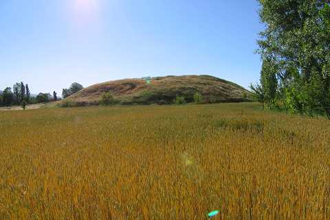 |
|
Type:
|
Mound |
|
Altitude:
|
950 m |
|
Region:
|
Aegean |
|
Province:
|
Kütahya |
|
District:
|
Merkez |
|
Village:
|
Parmakören |
|
Investigation Method:
|
Survey |
|
Period:
|
EBA II EBA III |
|
|
|
 |
|
| It is located at the entrance of the village of Parmakören; 1.3 km southeast of the village; 5 km southwest of the province of Kütahya. The mound is surrounded by fields and to the northeast is a swamp. It is a quite distinctive mound measuring 150x11 m. During the survey conducted by T. Efe in 1989; materials of the EBA II/III; the LBA and the Classical Period were collected from the surface. It takes place in the registered archaeological sites list prepared by Ministry of Culture and Tourism. |
| Location: |
| Geography and Environment: |
| History: |
| Research and Excavation: |
| Stratigraphy: |
| Small Finds: |
| Remains: |
| Interpretation and Dating: |