|
©The Archaeological Settlements of Turkey - TAY Project
|
|
|
|
|
|
Orman Mektebi Höyük |
|
|
For site maps and drawings please click on the picture...  |
For photographs please click on the photo... 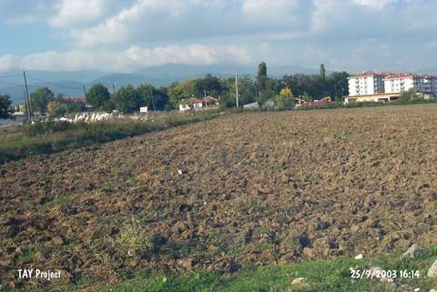 |
|
Type:
|
Mound |
|
Altitude:
|
755 m |
|
Region:
|
Black Sea |
|
Province:
|
Bolu |
|
District:
|
Merkez |
|
Village:
|
Merkez |
|
Investigation Method:
|
Survey |
|
Period:
|
|
|
|
|
 |
|
| It lies south of the building called Orman Mektebi which is now İzzet Baysal Anatolian High School; in the center of Bolu Province. To prevent any confusion with Asker Höyük; it is called Orman Mektebi. It is a small mound. It measures 5 m in height and 60x100 m in dimension. Inside a trench reaching until the virgin soil; pottery dating from the EBA as interiorly bright black and exteriorly red burnished transition ware from EBA to MBA (?) as well as wares of the second and first millennia BC and the Classical Period were recovered by a team under R.O. Arik. The settlement is particularly renowned with its first schematized anthromorphic EBA vessel. This vessel more or less exposes a relation between the Balkan Culture and Bolu and the Northwestern Marmara Region. The mound which is completely destroyed; was situated west-northwest of Karaçayir Muhiti in the north of Çigirtkanlar Cemetery; east-southeast of the irrigation canal in parallel to the road to Köprüçüler Village in the southwest of Bolu. |
| Location: |
| Geography and Environment: |
| History: |
| Research and Excavation: |
| Stratigraphy: |
| Small Finds: |
| Remains: |
| Interpretation and Dating: |