|
©The Archaeological Settlements of Turkey - TAY Project
|
|
|
|
|
|
Mürseller |
|
|
For site maps and drawings please click on the picture...  |
For photographs please click on the photo... 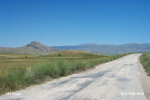 |
|
Type:
|
Mound |
|
Altitude:
|
1100 m |
|
Region:
|
Mediterranean |
|
Province:
|
Burdur |
|
District:
|
Karamanli |
|
Village:
|
Mürseller |
|
Investigation Method:
|
Survey |
|
Period:
|
|
|
|
|
  |
|
| It lies 300 m west of the Burdur-Tefenni highway; northwest of the Lake Karatas; some 5 km south of Mürseller Village; southwest of Burdur Province. It was discovered in 1982 by M. Özsait. It is possible that the Adatepe settlement investigated by J. Mellaart is actually Mürseller. It stands on a natural hill. It measures 250x150 m in dimensions. There is a stream bed joining to the Bademlidere through the northewestern foothill. Red washed or dark gray colored; incision decorated EBA pottery was collected from the surface as well as pottery dating from the Early Chalcolithic Age. It takes place in the registered archaeological sites list prepared by Ministry of Culture and Tourism. |
| Location: |
| Geography and Environment: |
| History: |
| Research and Excavation: |
| Stratigraphy: |
| Small Finds: |
| Remains: |
| Interpretation and Dating: |

