|
©The Archaeological Settlements of Turkey - TAY Project
|
|
|
|
|
|
Miyadin / Köyanala |
|
|
For site maps and drawings please click on the picture...  |
For photographs please click on the photo... 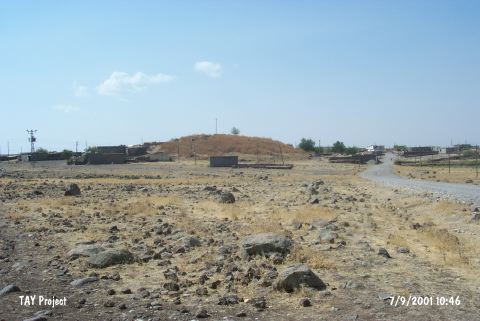 |
|
Type:
|
Mound |
|
Altitude:
|
760 m |
|
Region:
|
Southeastern Anatolia |
|
Province:
|
Diyarbakir |
|
District:
|
Ergani |
|
Village:
|
Koyunalan |
|
Investigation Method:
|
Survey |
|
Period:
|
|
|
|
|
 |
|
| It is a medium sized mound. It measures 15 m in height and 150x125 m in dimensions. It has been severely damaged because it lays beneath the contemporary village. To the southeastern section; ruins can be seen. To the north flows a waterway. It is coded under R 56 / 14. |
| Location: |
| Geography and Environment: |
| History: |
| Research and Excavation: |
| Stratigraphy: |
| Small Finds: |
| Remains: |
| Interpretation and Dating: |