|
©The Archaeological Settlements of Turkey - TAY Project
|
|
|
|
|
|
Miriktil 1 |
|
|
For site maps and drawings please click on the picture...  |
For photographs please click on the photo... 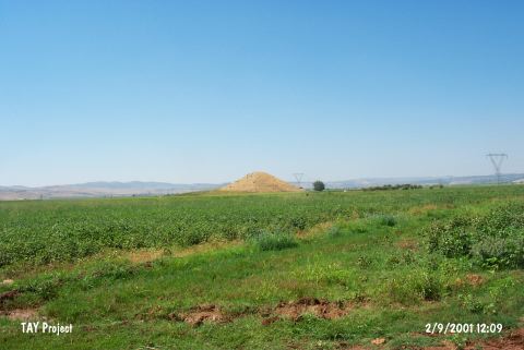 |
|
Type:
|
Mound |
|
Altitude:
|
580 m |
|
Region:
|
Southeastern Anatolia |
|
Province:
|
Adiyaman |
|
District:
|
Besni |
|
Village:
|
Yoldüzü |
|
Investigation Method:
|
Survey |
|
Period:
|
|
|
|
|
 |
|
| The mound lies southwest of Adiyaman and 3 km south-southwest of Yoldüzü (Mirhitli/Mirtikil) Village. It is 75 m in diameter; 20 m in height; and is discovered by C.A. Burney in 1957. Other than the EBA and later finds on the surface; probable Chalcolithic Age sherds are reported to be existent [Russell 1980:138]; and yet the issue stays debatable. It takes place in the registered archaeological sites list prepared by Ministry of Culture and Tourism. |
| Location: |
| Geography and Environment: |
| History: |
| Research and Excavation: |
| Stratigraphy: |
| Small Finds: |
| Remains: |
| Interpretation and Dating: |