|
©The Archaeological Settlements of Turkey - TAY Project
|
|
|
|
|
|
Menekse Çatagi |
|
|
For site maps and drawings please click on the picture... 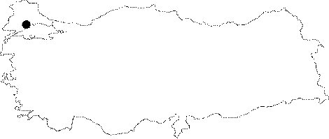 |
For photographs please click on the photo... 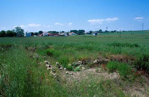 |
|
Type:
|
Mound |
|
Altitude:
|
7 m |
|
Region:
|
Marmara |
|
Province:
|
Tekirdag |
|
District:
|
Merkez |
|
Village:
|
Gazioglu |
|
Investigation Method:
|
Excavation |
|
Period:
|
EBA II EBA I |
|
|
|
 |
|
| Location: It lies on both banks of the Menekse Stream on rocky terraces; on the shore of the Marmara Sea; 50 m south of the Tekirdag-Istanbul motorway; 12 km east of the Tekirdag Province. |
| Geography and Environment: Flat hills lying on both banks of the Menekse Stream are named as West and East hills. In the section where the eastern and western mounds are located; shores of Marmara constitute a seaside cliff; 10 m high; formed by sandstone rocks. Beneath the cliff lie small beaches. There are two fresh water springs near the mound. The western mound measures 100x60x3 m while the eastern mound has two elevations; one measuring 2 m in height and 60 m in diameter east to the stream; and the other one being a flat elevation situated 200 m east of the stream. A portion of the eastern settlement has been truncated by the Marmara Sea. |
| History: |
| Research and Excavation: Menekse Çatagi was first documented during daily regional surveys by the Prehistoric Archaeology Department; University of Istanbul in 1960s after informed by M.A. Isin. The excavations were started in 1993 under M.A. Isin; director of the Museum of Tekirdag at present; and A. Erim-Özdogan from the Prehistory Section of the Istanbul University; and by the consultation of M. Özdogan. Excavations are still going on. Recent excavations are focused on Iron Age settlement. It takes place in the registered archaeological sites list prepared by Ministry of Culture and Tourism. |
| Stratigraphy: The upper level of the western settlement at Menekse Çatagi was dated to the Hellenistic Period (306-280 BC). Levels belonging to EBA I-II with the influence of Anatolia besides the local Thrace features; and the Middle Chalcolithic Age level (Culture of Toptepe) contemporary with the 3rd level of Kirklareli/Asagi Pinar were also uncovered. There are also evidence of settlements dating to the 2nd millennium BC and the Iron Age. As a result of the 2001 fieldwork; which was conducted on the Eastern settlement; four levels were determined: 1- Pits and offering pits dating to the Hellenistic Period; 2- Thu uppermost level dating to the Early Iron Age; 3- The hollow shelters level; 4- Rectangular planned mudbrick buildings phase. |
| Small Finds: Architecture: Levels dated to EBA yielded oval buildings with dimple bases constituted by plastering the periphery of a series of wooden posts by sandy clayed earth. Some has low domed ovens placed in the narrowing sections of the buildings while others have compartments made of wooden posts. In 2001; was revealed an EBA accumulation indicated by hearth and mudbrick wall traces. This accumulation is believed to have at least 4 phases. The most distinctive features are the semi-hollow shelters dug into the virgin soil and large furnaces and hearths with neat constructions. Pottery: EBA pottery was not published in detail. Generally; they are dark colored and burnished. Forms of bowls with unrolled rim are common. To the edges of the rims; pierced lugs; very typical of this period; are attached. Clay: Terra cotta spindle whorls were recovered. Other: Small finds were not published in detail. Presence of tools in ground stone; chipped stone and bones is known. Also found are animal bones and mussel shells. |
| Remains: |
| Interpretation and Dating: The excavation team proposes that materials of Menekse Çatagi are comparable with Troy I-II and Sveti Krilovo of Bulgaria; and it can be considered as a centre associated with the Anatolian trade network developed during the beginning of the third millennium BC. Its present location is not suitable to offer shelter to ships. Probably it was located on a small outcrop before being destroyed by the sea; and the Menekse Stream was creating a big bay. |