|
©The Archaeological Settlements of Turkey - TAY Project
|
|
|
|
|
|
Mecidiye |
|
|
For site maps and drawings please click on the picture...  |
For photographs please click on the photo... 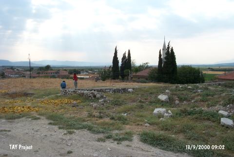 |
|
Type:
|
Mound |
|
Altitude:
|
110 m |
|
Region:
|
Aegean |
|
Province:
|
Manisa |
|
District:
|
Akhisar |
|
Village:
|
Mecidiye |
|
Investigation Method:
|
Survey |
|
Period:
|
|
|
|
|
 |
|
| The mound is located northeast of Manisa; west-southwest of Akhisar district; in the western section of Mecidiye (Palamut) Village; adjacent to the old mosque. The 5 m high mound with a diameter of 100 m lies on the west bank of Konurca Stream in a plain. It is occupied by the modern settlement. In the 1959 survey by D.H. French; black burnished ware sherds similar to those from Kumtepe I b phase are collected from the surface [French 1969:50]. It was researched again by E. Akdeniz et al. in 2007 and its dimensions were measured as 95x80 m and 6 m high. The mound's finds belong to a period between Late Chalcolithic Age and Late Bronze Age [Akdeniz 2009:257]. It is listed in the registered archaeological preservation zones inventory prepared by Ministry of Culture and Tourism. |
| Location: |
| Geography and Environment: |
| History: |
| Research and Excavation: |
| Stratigraphy: |
| Small Finds: |
| Remains: |
| Interpretation and Dating: |