|
©The Archaeological Settlements of Turkey - TAY Project
|
|
|
|
|
|
Liman Tepe |
|
|
For site maps and drawings please click on the picture... 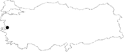 |
For photographs please click on the photo... 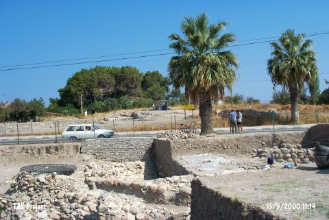 |
|
Type:
|
Mound |
|
Altitude:
|
0 m |
|
Region:
|
Aegean |
|
Province:
|
Izmir |
|
District:
|
Urla |
|
Village:
|
Merkez |
|
Investigation Method:
|
Excavation |
|
Period:
|
EBA I EBA II |
|
|
|
 |
|
| Location: It lies south of the Karantina Island; east of the modern harbor in the Iskele Quarter located north of the Urla District; west-southwest of the Izmir Province. It can be reached through the exit to the port of Urla from the Izmir-Urla highway which intersects the mound in the east-west direction by over passing it [Erkanal 1996:pic.6]. |
| Geography and Environment: The coastal plain on the north of Urla was; probably; formed by a long bay filled up later on. Firstly; the bay lost its contact with the sea due to a sand dune and then became an alluvial arose by the Zongurlu and Kocadere Streams. During this transformation; a group of natural rocks extending to the sea merged with the bedrock and ended up in a peninsula where Liman Tepe is located now. Due to the rocky block on the north; the peninsula is partly not open to the north winds. As the longitudinal ends of the rocky outcrop extending to the Gulf of Izmir serve like a natural port; and particularly the gulf has suitable conditions for sea trade; the site was occupied from the Late Neolithic Age. Fertile coastal plain on the south; probably; met all the food requirements of the inhabitants [Erkanal-Günel 1996:306]. As the ancient city of Clazomenai using the hill as acropolis which house the remains of the prehistoric settlements; was located on the southern part; it is clear that the site had been inhabited until the Roman Period. When it is noted that most of the ancient names derives from their prehistoric names; name of this site during the third millennium BC can be proposed as something similar to its ancient name. Liman Tepe has been partly destroyed by the summer houses on the coast and the neighboring territory. Excavation leader officially applied for moving the highway over passing the mound. |
| History: |
| Research and Excavation: Liman Tepe was first introduced as a prehistoric settlement by E. Akurgal [Akurgal 1950:4]. Excavations started at the ancient city of Clazomenai under G. Bakir and Ç. Anlagan in 1979. Later; excavations were extended to Liman Tepe considering the possibility that there can be an acropolis on the uphill. The 1980 and 1981 excavations yielded a monumental bastion/tower to the south of the highway as well as the significance of the settlement during EBA [Bakir-Anlagan 1981:88; Erkanal-Erkanal 1983:163-183; Bakir 1983:64-65]. Excavations covering only Liman Tepe have been continued since 1992 under H. Erkanal (See. References); and they are recently supported by the underwater excavations and geological researches conducted under the directorship of M. Artzy from the University of Haifa; Recanati Institute of Oceanography. The ancient city of Clazomenai has been explored since 1921-1922. |
| Stratigraphy: Some sherds recovered from the deposits of the late periods expose that the site had been first occupied during the Late Neolithic Age. Level belonging to the Middle Chalcolithic Age was uncovered in the trench to north of the highway. Heyday of the settlement was between EBA I and II. Trenches opened to the north of the highway yielded four building levels of EBA II and two building levels of EBA I while the southern trenches yielded only two building levels for now. It is noted that the MBA and LBA settlements are bigger compared to the EBA settlements. MBA houses 5 building levels and LBA only 1 level which were partly obscured by the buildings of the ancient Clazomenai of the Hellenistic and Roman Periods. The ancient city was expanded to the south. Exposure of a lesser degree of destruction on the uphill and presence of only one or two cisterns and well were concluded that this part was not heavily occupied during the late periods. |
| Small Finds: Architecture (ascending order): EBA I: Fortification walls; 92 cm thick; extending in the east-west direction uncovered in the northern trench expose that the settlement of this period was smaller than EBA II; but larger than Chalcolithic Age. H. Erkanal suggests that the 24x24 cm projections could be pillars strengthening the walls [Erkanal 1996:76]. Outer part of this wall is reinforced with battering in the lower portion just like the one at EBA II. The superstructure of the walls is suggested to rise in mudbrick. The substructure in stone is 2 m high. Inside the walls; remains of buildings leaning onto the wall were uncovered. Also found are domed kilns where flat stones were; first; laid onto the floor; and then sherds were put on it [Erkanal-Günel 1997:247]. To the north of this fortification wall; rectangular planned long houses were arranged side by side. The hoses were constructed with mudbricks on stone foundations and are believed to be reaching the fortification wall to the south. These houses were built in blocks that consist of more than two houses and the three houses uncovered belong to the same block. The second block may be to the east. Three floor levels were determined inside the house No.1. A golden band was found on the lowest third floor. Houses No.2 and 3 also have three floor levels. The remains of hard clay to the east of house No.3 may belong to a fourth house [Erkanal et al. 2003:424;425]. The earliest EBA I levels of the site were reached in 2002 to he immediate north of the terrace wall which was also recovered in the same season. Due to the lack of time and the destruction caused by the later periods; this phase was not examined thoroughly. In 2010, the western extension of the city wall belonging to Level VI (EBA I) was exposed. This section of the city wall with stone masonry was built on the stone foundation. The number of the long houses which lean towards the city wall increased to 6. 4 of these houses are approximately 23.30 m long and 4 m wide. The house E-5 which was unearthed on the west of the gate of the EBA I city wall is narrower than others. It is 1.14-1.40 m wide. Therefore, it has been suggested that this house called E-5 could be used for a different purpose. The house E-6 which was partly exposed on the east of the gate is also different from the other structures. This house doesn't lean towards EBA I city wall and its south wall was erected with the stones collected around. There is a 0.75-0.80 m space between the city wall and the house [Erkanal 2012:470]. EBA II: Inner Castle/Acropolis: People chosen Clazomenai/Liman Tepe for occupation during the midst of the third millennium BC enlarged it 7-8 m more than the preceding period and covered the ruins partly with mudbrick filling. The inner Castle settlement of this period is ringed by fortification walls; still preserved in places up to 4-6 m in height. Actual height couldn't be determined due to the water table. Although it was previously reported as these walls were supported by bastions; the 1999 excavation revealed that this bastion-like structure was; in fact; built to protect the fortress gate adjacent to it. Tower of the gate was built wider in the floor and decreased as it rose upwards so that it was given a battering appearance. This feature was given to prevent the collapse of the semi-circular tower. It is noted that it consists of small cells erected by flat stones like a cage by using loam mortar; and then stuffed with earth and stone ending up in a very sound structure. Thus; no excessive amounts of stones were used; and the risk of the load created by the weight of the mudbrick superstructure on the edges was eliminated. The outer surface was coated with local flat limestones placed side by side so that the city walls were given a good visual impression. It is suggested that the mudbrick walls continued in the superstructure grant a monumental appearance to the tower. It is rounded in the west; but flat in the east. This feature seen in the east suggests that the inner castle was entered through this gate. It was noted that the gate was bricked up or narrowed later on for unknown reasons. Future excavations will be involved in the explorations of the eastern gate-tower [Erkanal 2001:263-264; draw.2]. The 1999 excavation has laid out that this structure measures 20 m in width and 12 m in length. The 110 cm thick city walls built almost by the same technique lean over the tower. It is claimed by the excavator that the towers were built first; and then they were ringed by the fortification walls to complete the city walls. [Erkanal 1996:77]. Even though no excavation was carried out to provide any evidence; H. Erkanal extends the city walls until the Harbor in a sequence of bastion; city wall and bastion again etc. on the western part of the mound. This plan was not verified yet. It can be suggested that the walls of the city had been pierced by two gate-towers and one main gate. The city walls turn in loops as it is seen in the other contemporary settlements. Presence of very important monumental buildings inside the walls was proven with a building called "Corridor House" [Erkanal-Günel 1996:312]. Based on the finds; it can be said that it is a sanctuary. This building was used in all three levels of the EBA II. The walls are 1.5-2.2 m thick; and it is probably two storied. Limestones were used as the raw material. Loam mortar is visible between the stones. Usually smooth stones were used in the exterior surface while amorphous stones in the interior. The walls were supported by wooden posts in some places. It is assumed that there are warehouses underneath. The Corridor House served as a kitchen for a period of time and as a warehouse separated by walls for another time. It houses a big oven in the level it was used as a kitchen. It measures 1.2 m in width and 7.4 m in length in the lower building level while it gets shorter in another building level down to 5.8 m. Next to it lays another room; probably used as a hall. Paving of flat limestone plates is observed in this hall [Erkanal-Günel 1997:240-246]. Future excavations shall reveal all of the rooms of the Corridor House so that a definite plan of the building can be obtained. In 2001; the trench to the north of the settlement; which is also the highest area; has yielded important information about city planning. This high area was surrounded by a terrace wall and a suitable ground for settlement was prepared. On this ground; a settlement unit with a defense system was built. Two towers with a "U" shaped corridor between them and a well were recovered [Erkanal et al. 2003:429]. The excavations of the 2002 season were carried out around the corridor recovered in the previous years but the architectural connections of it have not been determined. The other EBA II finds of the season also include possibly a thick terrace wall. To the south of the wall were found rooms belonging to a building possibly contemporary with the wall. During the 2011 studies, 2 architectural layers belonging to EBA II were discovered. Two structures which damaged the second tower were exposed. These structures extend in the northwest-southeast direction and the one on the south (E-60) was preserved up to 9.20 m long and 2.60-2.80 m wide. The south wall of the structure, which its west wall was exposed in 2007, is 3.10 m in length and 0.65 m in height. The south side and eastern extension of the wall continue towards the area, which has not been excavated yet. The wall bordering the north of the structure is 9.20 m in length, 0.90-0.92 m in width and 1.10 m in height. The sidelines of the wall were filled with medium or large sized slab stones. E-67 located on the north of E-60 is 3.10-3.20 m in width and 7.90 m in length. A section of the north wall of the structure on the north forms the south wall. The west wall is 3.25 m in length and 1.10 m in height. This wall that was damaged by the silos on the later levels has an irregular stone masonry in various size. The exposed parts of the north wall of the structure measure 5.60 m in length, 0.84-0.92 m in width and 0.93 m in height. During the excavation which was conducted for the purpose of revealing the second tower, it was discovered that its wall D-571 arching towards the north continues 8.40 m to the north and extends towards the section which has not been excavated yet. The exposed parts of the tower measure 11 m in E-W and 8.40 m in N-S. Two walls extending in northwest-southeast direction were exposed during the excavations conducted on the east of the second tower. The one on the west is 2.05 m in length, 0.40 m in width and 0.90 m in height and the eastern extension of the wall turns to the north and forms a corner with a length of 0.60 m. the western extension of the wall leans on the tower and it was built with medium and large sized stone slabs. The other wall (D-631) located on the east of the wall mentioned above joins the section where the wall D-607 angles. Harbor: Excavation team of Liman Tepe also conducted an underwater survey when an air-photo taken in 1994 (Erkanal 1996:pic.6) yielded the traces of a mass in the Aegean Sea. And at 3 m depth; remains looking like a big and wide bastion on a natural rocky elevation; 100 m long and 35 m wide were revealed. This bastion (?) was protecting the small bay; that came out on the southwest; as a breakwater and it provided a shelter to the ships; being unaffected by the northern winds. Protection of the bay was supported by another breakwater; 30 m long and 5 m wide in the southwest of this structure. To the east of Harbor lie remains of a wall; probably of a port measuring 15 m in length and 2 m in width. Dating of these structures is difficult. Erkanal tends to date them to EBA II; for now; based on the impressive city walls with bastion. Rising date of the Aegean Sea or submerging date of those structures will allow us to estimate the construction and abandonment dates. Based on the geographical structure of the land; it is claimed that city walls extend to the Harbor in the northwest and northeast corners [Erkanal 1996:77]. In 2001 underwater excavations were conducted in two areas. In area A; 55 large pithoi sherds were found and the two soundings have not yielded any cultural remains. The remains of a 7 m long stone wall were found in area D. The wall consists of treated stones and is located on the extension of Liman Tepe in the sea. The first level has yielded scattered stones; numerous amphoras and fine ceramic sherds. The stratigraphy determined in this area begins from the 6th century BC and continues until the 3rd millennium BC [Erkanal et al. 2003:431;432]. A new area called A3 was added to the underwater excavations of 2003. To the east of this area a massive stone group was encountered but it has not been clearly dated yet. Lower City: During the recent excavations (until 1988); the trench on the immediate south of the highway was enlarged and deepened as far as the possibilities allow. A stone-paved street was uncovered extending to the south from the bastion. The street is lined with houses on both sides. The walls of one of the houses are still preserved up to 1.34 m. Remains of an apsidial house and a big building with thick walls were also found [Erkanal 1999:327]. Two building levels belonging to EBA were uncovered. As the southern part of the mound is obscured by the ancient city of Clazomenai; the excavations became harder and the destruction of the upper levels was augmented. Results concerning the defense system of EBA II were achieved following the excavations performed on the south of the northern excavation area at Limantepe in 2005. It was found that the eastern façade of the tower which is part of the EBA II defense system extends towards the north after passing underneath the Izmir-Urla motorway. A collapsed wall was revealed in the east of the tower's extension; which extends in east-west direction. The southern section of the northern excavation area was expanded towards the east in 2006; in order to identify the character of the defense system wall which extends in east-west direction. EBA IIIB is another layer which was identified in this area. The northeastern corner of a building and the bottom of a furnace in the west of the excavated area; then a wall and and a furnace in the southeast constitute the remains in this layer. The other remains inside this area were dated to EBA IIIA. An embankment that extends in the direction of northeast that belongs to this layer was revealed. The oldest remains that were unearthed inside the excavated area were the ones dated to EBA II. Two EBA II building layers were unearthed in this area. Building Layer 1: A wall which is contemporary of the late phase of EBA II layer; and the western section of a building were revealed. The wall that was unearthed at the westernmost part of the area (D-561) extends in northeast southeast direction. The wall measures 3.10. m long and 1.13 m wide and one course of the wall was preserved. Building Layer 2: Following the excavations performed at Limantepe in 2005; it was found that the eastern façade of the tower which is part of the EBA II defense system extends towards the north after passing underneath the Izmir-Urla motorway. During the excavations performed in the southeast of the northern excavation area in 2007; finds were revealed that belong to periods A and B of EBA III. The remains from EBA III B at Liman Tepe were partially preserved but this does not unveil the entirety. The wall remains and furnaces that were partially preserved in that area are particularly important in terms of showing how the settlement spreaded during EBA IIIB. A stone embankment was revealed which belonged to EBA IIIA period. It was found that this embankment destructed both the EBA II defense system and the late period building of the EBA II. During the excavations performed at Liman Tepe in the previous years similar remains were revealed inside the southern excavation area of the EBA II defense system. Due to such similarities it was unveiled that housing was started on EBA IIIA defense system which is similar to the housing on the EBA II defense system [http://www.ttk.org.tr/index.php?Page=Sayfa&No=196; 2.6.2008; 12:50]. Two EBA II building levels were discovered southeast of the 2007 campaign north excavation area [Erkanal et al. 2009:303]. Dimensions of House No. 2, which extended in north-south direction with a long rectangular plan and had a door on northern side, was reached to 25 m length and 4.50 m width in 2008 season excavations. Building had at least 3 phases and each of them used with different internal divisions. Some rooms had dividing walls with stone foundations, though some of them built directly by mud brick. There were several fireplaces built over on each other at the southern part of the building. This area was probably used for preparing food and also as an atelier through all phases. House No. 2 had sequential architectural layers beginning from second half of Western Anatolia EBA I to the early phases of EBA II. The earliest phase of House No. 2 was ended by a strong earthquake and western wall collapsed into the house as for the eastern wall into House No. 3 [Erkanal et al. 2010:348-350]. House No. 3 had the same plan with House No. 2 and its earliest phases were parallel with House No. 2. Fireplaces built over on each other were uncovered almost at the same place with House No. 2 in the main room at the southern half of House No. 3. There was a circular pit in the middle of the earliest fireplace. This finding suggested that the fireplace might have been used for metal working at that period. Studies of previous seasons proved that the most important industrial activity of the house was oriented to weaving. The western mud wall of House No. 3 was covered with a thin white plaster. Eastern wall lay under a wall dated to late period of EBA II [Erkanal 2010:350-351]. A new excavation field is set in 2009 in Trenches U-6 and T-6 to allow a more detailed study of House 1 which is located in the South of North excavation field. 7 waste pits are identified in these trenches one of which belongs to Late Bronze Age and the remaining six belongs to Middle Bronze Age. Two new pits are located after removing the waste pits during the excavations in Field T-6. New information is gathered on the settlement in Layers MBA 3 and 4. Various furnace bases and the areas not excavated previously in the block of buildings which is made of 7 oval houses which were excavated during previous years. Other than the oval houses which are ordered in East-West direction a furnace base is excavated in Field U-6 Plan Square VII-X/b-c from Liman Hill Layer III3 in the West side. The furnace is used continuously and at least five independent renewal phases are identified. Another furnace base from MBA Layer 3 is unearthed in Plan Square VII-X/b-e of Trench U-6. When the orange-like color conical chamber is removed a round grinding stone is captured below in situ. As a result of digging deeper in the field, three more furnaces are unearthed from MBA Layer 4 below the furnaces already located. Stone paved oval part of the first oval house (Oval House 1) is excavated and found it is pretty well-preserved. The walls are 3.60 m long and 0.60 m thick and the preserved part of foundations are 0.70 m high. Internal facts of walls are made by laying large stone blocks, and the rear sides are made by laying irregular medium sized of stones roughly. The base of oval part of the house is paved with large size plate stones. In the South side of House 1, a tiny part of a wall of the oval part of another house is unearthed. An approximately 70 cm wide door opening is located in the West side of the wall which enters the profile. The door opening is limited by vertical plate stones on two sides and it is on the wall which constitutes the oval part of House 3. The internal face of the wall is constructed by laying middle-large stones vertically in part. 3 furnace bases are identified inside the house. The door opening on the oval side of the oval house was canceled during its period possibly by narrowing the building. A second wall is identified starting from the door opening reaching about 2 m East [Erkanal et al. 2011: 447-449]. A stone wall extending in the east-west direction was exposed in Level LMT V in 2010. The wall measures 6 m in length and 0.90 m in width. The middle section and the eastern extension of the north side of the wall have been damaged. Among the finds recovered from the south of the wall, there are bone drills, a bone amulet and blades made out of Melos obsidian [Erkanal et al. 2012:468]. 4 pits have been discovered in Level LMT IV 2 dated to EBA III. The diameters of the pits range from 1.20 m to 2.20 m while the depths range from 50 cm to 70 cm. A few potsherds and carbonized grains were found in the pits. In Level LMT IV 1, a floor of an oven with an ash pit beside and a pile of stones were unearthed [Erkanal et al. 2012:469]. The excavations yielded remains belonging to the Roman Period, 4th century BC, LBA, MBA and EBA. During the studies conducted in the north of the area, which yielded remains belonging to the transition period of EBA to MBA, a pottery kiln was found. The mouth of kiln faces to the northeast. It is in quadrangular shape. The walls of kiln were built with mud brick on stone. To the south of the kiln, four siloi were exposed. In the level dated to EBA II (LMT V), remains belonging to two building levels were unearthed. The first building level (LMT V.1) yielded four structures. These structures located in the north of the House E-4 extend in the northwest-southeast direction. The back walls of these houses sit on the EBA II defense system in the west. The long walls of the houses are shared. They are 3.40-3.45 m in width. The walls have two different phases. In the early phase, the walls were built with medium sized thick stone slabs. In the later phase, medium and large sized stones were used to erect the walls. It was documented that the floors of the houses were white plastered and the walls were painted with red ochre. Bronze chisels, borers, miniature axes, flint and obsidian blades, stone amulets, stone idol and horn handle were found in these houses. The aim of the excavations conducted in the second building level (LMT V.2) was to expose the continuation of EBA II defense system. It was observed that the second bastion continues towards the north and then stopped after forming a straight line. A communicating door was opened inside the bastion controlling the east of the EBA II city. The excavations carried out in the doorway revealed a stairway with five stairs. Antae were built with stone slabs on both sides of the door and these antae sit on the bastion [Erkanal et al. 2014]. In 2013, a road extending in the northwest-southeast direction was exposed in the cultural layer of EBA IIIA (LMT IV.2). The road measures 6.30 m in length. It is 2.20 m wide in the east and 0.88 m wide in the west. The central section of the road was paved with thick stone slabs. The long sides were bordered with small and medium sized slab stones. During the excavations carried out in the damaged edges, a channel was exposed below the road. Both sides of the channel were flanked by thick slab stones. Its ceiling was paved with slab stones. The channel measures 0.25-0.27 m in depth and 0.45-0.56 m in width. The road and the channel dated to EBA IIIA are unique for Anatolia in this period. The road and the channel are not related to any architecture. It is possible that they were used for cultic purposes. Three building levels were determined in the cultural layer of EBA II (LMT V). In the building level of LMT V.1, a fill of stone extending in the northeast-southwest direction was exposed. The studies show that the remains belonging to the building level 2 were covered with this stone fill. In the building level of LMT V.2, two walls (D-722) and a temenos wall (late phase) were unearthed. The early phase of the temenos wall, a building extending in the northeast-southwest direction and two damaged buildings were exposed in the building level of LMT V.3. The temenos wall unearthed in this building level is unique for Liman Tepe. The wall should have encircled an important structure. The road exposed in the west of the temenos wall and the structure (comprising of magazine-like rooms) found near the road indicate an organized settlement belonging to EBA II. The studies were carried out in the cultural layer of EBA I in order to expose the extensions of House E-3 and E-5 that were discovered in previous seasons. It is found out that the extensions of both houses (the northeast corner of House E-3 and the north section of House E-5) were truncated and leveled by the cultural layer of EBA II [Erkanal et al. 2015]. EBA III: The excavations were carried out in the areas of T-U-V/6 (LMT Level IV.1). The excavation conducted in these areas in 2007 and 2010 yielded votive pits belonging to EBA IIIB. During the studies carried out in 2014, it is seen that the walls in one of the pits opened into the stone fill of EBA IIIA were erected with medium and large sized stones. During the studies carried out in the east and west of the wall D-780 in the building level LMT V.2, a pavement built with broken stones was found. This pavement extends in the east-west direction. Below this pavement, a structure (M-82, belongs to building level LMT V.3) extending in the northwest-southeast direction was found. The exposed section of this structure measures 10 m in length and 3.45 m in width. The entrance measuring 96 cm in width locates to the west. The entrance was bordered with a wall (D-786) from the north. A thick stone slab was placed in the entrance. Also, the entrance was bordered with walls extending in the east-west direction from outside and a corridor was formed [Erkanal et al. 2016: 329-330]. Ceramics (ascending order): EBA I: Dark gray colored ware was found. Horizontal tunnel handled cups are typical. Vast majority of the black washed and burnished ware in the lower level is bowls with unrolled rims. Spouted pitcher and three footed vessel of buff colored coarse ware were recovered [Erkanal-Günel 1998:389-390; pic.6]. In 2010, potsherds of Urfirnis sauce-cup, painted wares belonging to Early Cyclades II, a sauce-cup potsherd and tools made out of Melos obsidian were recovered inside the houses in Level LMT VI. A sauce-cup fragment found in house E-1 belong to "yellow mottled" ware group and this potsherd is the first example found in Anatolia [Erkanal et al. 2012:471]. Sherds of Troy A6 type were found during the 2002 excavations EBA II: Brown pasted; dark gray washed and burnished ware recovered from the Corridor House comprises the vast majority of the industry. Flat bottomed and round shaped bowls are products of this ware. Also found are flat bottomed and three footed vessels with cylindrical necks. Samples of thin-walled; red washed and burnished ware are rarely seen. Very limited numbers of sauce-cups are assumed to be imported to Liman Tepe. One sample of this ware is a deep vessel with a diagonal relief-decorated handle. The 2002 excavations of the corridor have yielded sherds of Troy A12 and A16 type. Sherds of tripod bowls and a relief decorated bowl are also among the finds of this season. Parallel thin lines; concentric triangles; dots; rhombs; vertical relief bands; deep grooves on handles are common decorations of the EBA pottery industry. The earliest wares found in House No. 2, which extended in north-south direction with a long rectangular plan and had a door on northern side were showing the characteristic forms of Western Anatolia brown and dark burnished ware. Pedestal bowls and cylindrical necked pots were the most characteristic forms [Erkanal et al. 2010:349]. Various Miken pottery pieces and matte painted pieces are captured in 2009 alongside the local pottery samples in Late Bronze Age waste pits. Within this field the soil is dark brown and has an ashy formation and it contains large pithos pieces. An incense vessel is captured inside the House 1 which previously known from Çesme-Baglararasi excavations [Erkanal et al. 2011: 447-449]. In 2010, upper part of a zoomorphic vessel with ram head, a baked clay bird or goose head and a neck sherd was found among EBA II potsherds which were recovered on the north of the wall in Level LMT V [Erkanal et al. 2012:468]. In 2012, the excavations conducted in the first building level (LMT V.1) yielded quite few pottery sherds. Among these sherds, there are A12 and A16 type, black and brown slipped and burnished potsherds. The forms consist of dull red slipped, shallow conical plates with simple rims. During the excavations carried out in the doorway and in front of the anta, a great number of potsherds were found. A16 type ring based bowls are common among these potsherds. A model of boat made out of baked clay is noteworthy as well [Erkanal et al. 2014:503-504]. EBA III: During the studies conducted in the building level LMT IV.1 in 2014, sherds belonging to a bowl with thickened out rim and sherds of a vase with lid were found inside the votive pit. The building level LMT V.1 yielded bowls with conical body and simple rim and bowls with inverted rim and carinated shoulder. Sherds belonging to bowls with inverted rim and carinated shoulder and neck sherds of jars were recovered from the structure M-82 in the building level LMT V.3 [Erkanal et al. 2016: 329-330]. Clay: Terra cotta loomwheights; spindle whorls; spoons and a plate were recovered. Another find is a narrow-waisted idol with round shoulders; arms depicted with projections. In 2002; the body part of a brown colored burnished figurine. Pieces of fine quality red and black slipped ceramics (which are characteristic wares of period of "Anatolia Trade Age") are found in 2007 among the ceramics captured in the embankment on a building belonging to Late Period of EBA II. In terms of forms of the captured vessels depas and tankard type vessels exist as well as wheel-made plates [Erkanal et al. 2009:303]. Special forms of ceramics such as shallow pots, tankards and depases are also captured in the excavations carried out in the middle of the field [Erkanal et al. 2009:306]. High quality ceramics are unearthed in situ on the base grounds of houses belonging to EBA I [Erkanal 2009:308]. Ground Stone: The Corridor House of EBA II yielded flat-bottomed; round headed small objects identified as phallus by the excavator. Head of one is like a monkey. It is suggested that those objects [Erkanal-Günel 1997:pic.3] reveal the relation of a central authority; i.e. ruler of the city; with religion. Also found is an idol in marble with a cornered body and a round head. Metal: Copper slags are a good indication of the workshops at Liman Tepe. Circular core-crashing tools with lugs and a mould prove the execution of an intramural mining. Rectangular prism shaped mould is for casting axes. However; number of metallic finds is not much. Two bronze needles, one miniature, a double sided axe with its puncture handle is captured inside the House 3 in 2009 [Erkanal et al. 2011: 449]. Human Remains: Beneath the second floor level of house No.3; a pithos grave of a baby was found. The skeleton in the short necked and tripod pithos is scattered. A handled bowl and a pyramid shaped red stone were left as burial gifts [Erkanal et al. 2003:425]. Animal remains: Tortoise shells were unearthed inside pits dug at EBA III level in the center of north excavation area. Tortoise shells or their fragments were found inside each of the 12 pits that were dug [Erkanal et al. 2009:306]. |
| Remains: |
| Interpretation and Dating: H. Erkanal, leader of the excavation team, reports that the site is the most suitable place for settlement in the Gulf of Izmir and its surrounding territory [Erkanal 1996:76]. Liman Tepe was a big and organized port city covering an area of 6 ha. during the third and second millennia BC. The corridor called as Corridor House [Erkanal-Günel 1996:312]; the biggest one ever seen in the Aegean basin; is the center of a monumental building. It is suggested that the plan of this house was developed from megaron-like buildings. Probably it is the building of the ruler or the central authority. Liman Tepe consisting of an Acropolis and Lower City is the indication of a real political and economical power with its strong fortifications; big "Corridor House" and building complex related to this house. While likes of "Corridor House" were uncovered in Greece mainland; it was found only at Liman Tepe in Western Anatolia. The pottery of EBA is compared with the contemporary cities like Troy; Poliochni; Thermi and Samos. Furthermore; pottery styles associated with Cyclades Islands and Greece mainland recovered at Liman Tepe are important for illuminating the relationship between the two regions. It is assumed that Liman Tepe was a part of the sea trade between the Anatolian coast and the Cyclades Islands; and the goods brought from the inner parts of Anatolia were loaded and exported here. Likewise; imported goods from the Aegean Islands were unloaded here. The EBA I settlement was suggested to date to the last phase of this period [Erkanal 1999:330]. It is almost contemporary with Troy I and Early Cyclades I while the settlement of EBA II is contemporary with Troy II. Dating of the settlements is not definite yet. The large-scale buildings unearthed in 2007 were dated to late phase; EBA II; and these are important in terms of showing the development of the settlement during EBA II. A similar building which was built over the tower dated to early phase of EBA II; and which destructed it; was also revealed during the previous years; over the tower on the southern excavation area. These remains which were unearthed both on the northern and the southern excavation areas; show that the defense system built in the beginning of EBA II had lost its function during the late phase. The earliest period remains revealed on the southeast of northern excavation area constitutes a declined wall dated to the early phase of the EBA II period. This declined wall which is connected to the EBA II tower from the east must be related with the defense wall. This should be forming the southern wall of another tower that is similar to the tower inside the southern excavation area both in terms of its technique and its size. Based on this revealed section the EBA II settlement was protected by two very closely built towers on the southeastern direction. The completely revealed one of these towers controlled the southern direction and the partially revealed one probably controlled the east [http://www.ttk.org.tr/index.php?Page=Sayfa&No=196; 2.6.2008; 12.50]. The tortoise shells and potsherds found in 12 pits at EBA III layers, which were uncovered in the middle of the north excavation area in 2007 season estimated as the remains of a collective ceremony devoted to life and fertility, especially when it was considered that the pits were carefully covered in a sense they were sealed after use. Depending on the presence of tortoise shells in the pits, it could be said that they had been used as musical instruments or symbols in rituals related to life and fertility. The special usage and fertility related symbolic use of tortoise shell known from Nevali Çori PPNB layers and Late Neolithic Kortik Tepe in Anatolia. Sea turtle shells about all of them preserved also found in PPNB layers of Akanthou - Arkosykos / Tatlisu Çiftlikdüzü in Cyprus. In Aegean region, the different usage of tortoise shells only known from Mycenaean City / Sanctuary Phylakopi in Melos so far [Erkanal et al. 2009:306-307]. |