|
©The Archaeological Settlements of Turkey - TAY Project
|
|
|
|
|
|
Lidar Höyük |
|
|
For site maps and drawings please click on the picture... 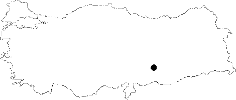 |
For photographs please click on the photo...  |
|
Type:
|
Mound |
|
Altitude:
|
448 m |
|
Region:
|
Southeastern Anatolia |
|
Province:
|
Sanliurfa |
|
District:
|
Bozova |
|
Village:
|
Dikili |
|
Investigation Method:
|
Excavation |
|
Period:
|
EBA III EBA II |
|
|
|
 |
|
| Location: The mound is located northwest of Sanliurfa; just southwest of the village of Lidar 23 km north of the district of Bozova. The site is partially occupied by the modern village and since it was on Euphrates' bank it is today inundated by Atatürk Dam. The location code of the site is T 51 / 40. |
| Geography and Environment: The 200x240 m mound is 25 m high from the plain it is on. It is quite a large site together with its cone and its northeast and southwest terraces. There is a 100x110 m plain area on the top of the mound following the rather steep slopes. It was probably a preferable site to settle since at this location; it is possible to cross over the Euphrates. It may be assumed that the site; together with Gritille right across it; was controlling this essential route. |
| History: |
| Research and Excavation: The site is discovered in 1977; and excavated under H. Hauptmann in the name of the German Archaeological Institute and the University of Heidelberg from 1979 until the year it was flooded by the Dam (1987). Excavation lasted for 9 seasons were mainly concerned with the enlightment of the upper levels. The EBA levels were revealed by the stepped trench in the northwest and southwest. It takes place in the registered archaeological sites list prepared by Ministry of Culture and Tourism. |
| Stratigraphy: Survey yielded the finds of the Aceramic Neolithic Age; the Ceramic Neolithic Age; the Chalcolithic Age (Halaf; Obeid and Uruk); the EBA; the second millennium BC; the Iron Age; the Hellenistic Period and the Middle Age whereas as a result of the excavation; it was documented that the site was certainly inhabited from EBA to Middle Age. It is reported that five stepped excavation on the northern slope aiming to locate earlier levels didn't yield any finds of pre-EBA periods. Accumulations of the EBA settlement have a cultural deposit of 11 m thick with 14 building levels. The EBA levels were identified by H. Hauptmann as Phases I-IV which indicate the presence of settlements dating from Ur Dynasty I to Ur III Period based on the Mesopotamian chronology. |
| Small Finds: Architecture: The earliest settlement identified during the excavation is dated to the end of EBA I. It is observed that the site was ringed by a fortification wall made of 2 m thick mudbricks. Inside the fortification walls; there are houses adjacent to the wall housing circular disc-shaped hearths; mudbrick walls and single rooms [Mellink 1984:pl.58/5]. 3 rooms were uncovered. Only 8 m of the fortification walls were brought to light. In upper levels; a transition from buildings with single rooms to buildings with multi-rooms is observed. As construction technique; walls were partly erected by quarry stones. Dimensions of the rooms are 4x4 m and 4.5x2 m. They were uncovered in a small area; and dated to EBA II. Latest building level of EBA III underwent a fire. To the southwest of the mound lies a location for pottery production outside the houses. This area yielded five levels with pottery workshops including 19 kilns ranging from horseshoe-like kilns of 5x2.5 m to the well developed two storied kilns of 2.6x3.4 m. In those two-storied kilns; hearth is separated from where the pottery are fired by a grilled (perforated) floor [Hauptmann 1999:72;pic.12]. They are suggested to have domes. Around the kilns; unfired vessels were found. Pottery: Samples of plain fine ware of EBA I-IIa were recovered from the lowest level surrounded by the fortification walls. They include goblets decorated with red incisions and filled in triangles. Levels comprising of complex buildings with multi-rooms yielded pottery of ware types recovered from Level H of the Amuq Plain. Around the above mentioned kilns; plenty of light color pasted; plain or incision decorated ware was found. It is suggested that big rough vessels were fired at horseshoe-like kilns whereas fine wares were fired at two-storied kilns with single rooms [Yakar 1985a:335]. All pottery bear the sign of the atelier they were fired. This suggests that the potters of Lidar were self-confident of their work [Hauptmann 1983:96]. Human Remains: An intramural cemetery consisting of cist graves was uncovered to the east of Lidar Village and the mound. It was identified by grave goods that 205 of those graves were built by the inhabitants of this settlement during the end of EBA I-II and EBA III [Hauptmann 1997:1115]. Walls of the graves were built by standing flat stones. Children were buried into the ones 65-95 x 50 cm in dimensions and adults into 80x160 cm graves. The dead were interred in hocker position; their head oriented toward the northeast. As grave goods; plenty of intact cups [Hauptmann 1983:fig.11]; stone axes; rings; pins (shroud pins); bracelets and necklaces made of stone beads were left into the graves. Southern part of the cemetery yielded chamber graves built; bigger than the other graves; with quarry stones and capped with flat plate stones which are also dated to EBA III by the excavator depending on the typical characteristics of the grave goods. Entrance to the graves fronting the west was bricked up with a stone lid. Resting position of the deads is similar to other graves. Two chamber graves found in the squares G 33-34 on the western part of the mound; were built side by side; and they were dated to EBA III. Construction technique is similar to the contemporary graves. After digging a pit; big quarry stones were erected neatly with a single face surrounding the pit in three sides. Fourth side was left as entrance and closed with a treated four-cornered plate stone after the burial ceremony. Dimensions are 250x160 cm [Hauptmann 1983: fig. 7-10]. Finding 25 skeletons in two graves indicates that those graves were used over and over again. Latest burial in each chamber belongs to female skeletons. In the rear and entrance parts of the graves; intact vessels [Hauptmann 1983: fig. 12]; bronze pins and bead strings were found. Other than private belongings of the dead; presence of cups for presenting food and beverages enriches the inventory of this period. It is claimed that band decorated or spiral retouched cups are also found in the concurrent cemeteries uncovered in Syria [Hauptmann 1997:1115]. |
| Remains: |
| Interpretation and Dating: It is impossible to propose that the EBA settlements of Lidar Höyük are insignificant. As EBA levels were not reached through the trenches because of the rapid increase of the water level of the Atatürk Dam over the hill; and only trenches on the slopes yielded restricted architectural remains belonging to EBA settlements; it is difficult to obtain good results about the architectural structures. However; pottery recovered particularly from the cemetery and pottery workshops provide some information about the production and trade relations of the settlement. The EBA II level of the mound is dated to Phase H of the Amuq Plain by H. Hauptmann [Hauptmann 1997:1115]. Finds are compared with the finds of Kurban Höyük VA-IVA; Harran and Tell Chuera in Syria. Burial traditions resemble the ones identified in Southeastern Anatolia; and chamber graves are found identical to the "Hypoge" recovered at Til Barsib. Political and ethnical changes are observed at Lidar in the end of EBA [Hauptmann 1999:72]. It is associated with the expansion of Akkads or Hurri. |