|
©The Archaeological Settlements of Turkey - TAY Project
|
|
|
|
|
|
Kültepe |
|
|
For site maps and drawings please click on the picture...  |
For photographs please click on the photo... 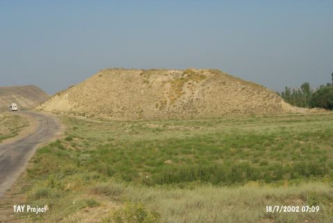 |
|
Type:
|
Mound |
|
Altitude:
|
585 m |
|
Region:
|
Central Anatolia |
|
Province:
|
Çorum |
|
District:
|
Ugurludag |
|
Village:
|
Eskiçeltek |
|
Investigation Method:
|
Survey |
|
Period:
|
|
|
|
|
 |
|
| It lies 700 m west of Eski Çeltek/Eskiçeltek Village of Ugurludag District; west of Çorum Province. It is an oval mound. It measures 20 m in height above road level together with the natural hill beneath and 100x150 m in dimensions. 100 m away passes by an irrigation channel. Illicit diggings are informed from time to time. It was discovered during the Survey of Çorum conducted under T. Sipahi and T. Yildirim in 1996. Only sherds dating from the EBA were collected from the surface. The researchers claim that the site probably used to locate next to the Kizilirmak River during the third millennium BC. |
| Location: |
| Geography and Environment: |
| History: |
| Research and Excavation: |
| Stratigraphy: |
| Small Finds: |
| Remains: |
| Interpretation and Dating: |