|
©The Archaeological Settlements of Turkey - TAY Project
|
|
|
|
|
|
Kültepe |
|
|
For site maps and drawings please click on the picture...  |
For photographs please click on the photo... 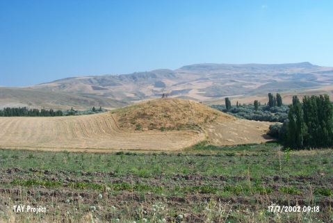 |
|
Type:
|
Mound |
|
Altitude:
|
720 m |
|
Region:
|
Central Anatolia |
|
Province:
|
Çorum |
|
District:
|
Bayat |
|
Village:
|
Barak |
|
Investigation Method:
|
Survey |
|
Period:
|
|
|
|
|
 |
|
| It is located 1.1 km northwest of Barak Village; on the north bank of Kizilirmak River (The Halys); southwest of Iskilip-Bayat. It is ca. 10 m high. On the top hill; presence of a tumulus is claimed by A. Gökoglu. Sherds of the exteriorly and interiorly red colored ware or the exteriorly red and interiorly black colored ware were collected from the surface. They were evaluated in the same group with the sherds of the straw tempered; handmade; burnished and red ware. |
| Location: |
| Geography and Environment: |
| History: |
| Research and Excavation: |
| Stratigraphy: |
| Small Finds: |
| Remains: |
| Interpretation and Dating: |