|
©The Archaeological Settlements of Turkey - TAY Project
|
|
|
|
|
|
Kül |
|
|
For site maps and drawings please click on the picture...  |
For photographs please click on the photo... 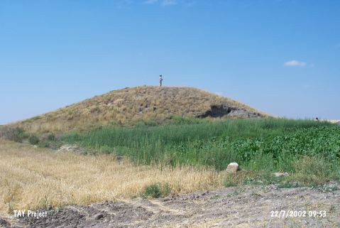 |
|
Type:
|
Mound |
|
Altitude:
|
1080 m |
|
Region:
|
Central Anatolia |
|
Province:
|
Yozgat |
|
District:
|
Yenifakili |
|
Village:
|
Çöplüçiftligi |
|
Investigation Method:
|
Survey |
|
Period:
|
Late |
|
|
|
 |
|
| The mound lies 1.8 km southeast of Çöplüçiftligi Village; south of the centrum of Yozgat in the valley of Delice River. It is discovered in 1989 by the team conducted by S. Omura. Little information is published about the site. The collected sherds are declared similar with Alisar Late Chalcolithic Age pottery. |
| Location: |
| Geography and Environment: |
| History: |
| Research and Excavation: |
| Stratigraphy: |
| Small Finds: |
| Remains: |
| Interpretation and Dating: |