|
©The Archaeological Settlements of Turkey - TAY Project
|
|
|
|
|
|
Armutak |
|
|
For site maps and drawings please click on the picture...  |
For photographs please click on the photo... 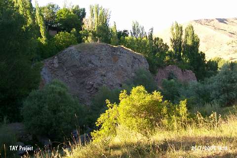 |
|
Type:
|
Mound |
|
Altitude:
|
1350 m |
|
Region:
|
Central Anatolia |
|
Province:
|
Sivas |
|
District:
|
Divrigi |
|
Village:
|
Kavaklisu |
|
Investigation Method:
|
Survey |
|
Period:
|
|
|
|
|
 |
|
| It lies immediate east of Kavaklisu (Armutak) Village; south-southwest of Divrigi District; southeast of Sivas Province. It measures 50 m in diameter. It has been partly destroyed by Vartan Stream nearby. The hill called Büyük Kale is southwest of the mound. It was discovered in 1956 by C.A. Burney. Samples of the Karaz/Early Transcaucasian ware with different exterior and interior surface colors and sherds of the red-brown burnished ware were collected from the surface. |
| Location: |
| Geography and Environment: |
| History: |
| Research and Excavation: |
| Stratigraphy: |
| Small Finds: |
| Remains: |
| Interpretation and Dating: |