|
©The Archaeological Settlements of Turkey - TAY Project
|
|
|
|
|
|
Kuyuluk |
|
|
For site maps and drawings please click on the picture...  |
For photographs please click on the photo... 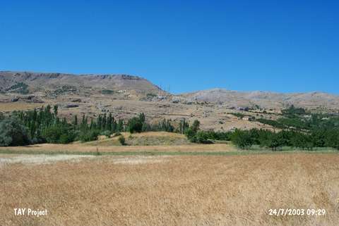 |
|
Type:
|
Mound |
|
Altitude:
|
1260 m |
|
Region:
|
Eastern Anatolia |
|
Province:
|
Malatya |
|
District:
|
Hekimhan |
|
Village:
|
Güzelyurt |
|
Investigation Method:
|
Survey |
|
Period:
|
Early Middle |
|
|
|
 |
|
| The mound is located on north bank of Kaynarca Stream; west-northwest of Güzelyurt Town; south of Hekimhan District of Malatya. North of the mound is cemetery and 1 km east is Hasartepe settlement. It is 3 m high; small mound with a diameter of 50 m. It was discovered by C.A. Burney in 1956. The Chalcolithic Age pottery from the surface of the mound consists of import Halaf ware; local Halaf ware and paint decorated Ubaid pottery. The few import Halaf ware sherds are of pinkish-buff and plain buff wares and are red or orange-red painted on both surfaces [Burney 1958;fig.3-5]. The settlement dates to 7-9th phases in ASPRO [Hours et al. 1994:219]. |
| Location: |
| Geography and Environment: |
| History: |
| Research and Excavation: |
| Stratigraphy: |
| Small Finds: |
| Remains: |
| Interpretation and Dating: |