|
©The Archaeological Settlements of Turkey - TAY Project
|
|
|
|
|
|
Kuruhöyük |
|
|
For site maps and drawings please click on the picture...  |
For photographs please click on the photo... 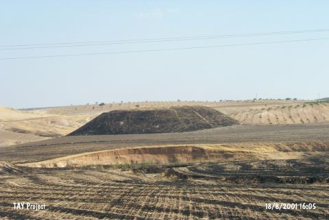 |
|
Type:
|
Habitation Site / Workshop |
|
Altitude:
|
610 m |
|
Region:
|
Southeastern Anatolia |
|
Province:
|
Gaziantep |
|
District:
|
Nizip |
|
Village:
|
Nahirtepe |
|
Investigation Method:
|
Survey |
|
Period:
|
OP |
|
|
|
 |
|
| Location: The site is east of the city of Gaziantep; between the villages of Kerzin and Kaleköy; southeast of the town of Nizip; 1.500 m east of the highway between Nizip and Cerabus and 8 km from Nizip itself. (Please see the Asagi Nizip Yöresi for more information on the sites in this region). |
| Geography and Environment: Perrot does not provide detailed geographical or topographical information on this site. |
| History: |
| Research and Excavation: J. Perrot's 1961 survey of Kuruhöyük yielded Palaeolithic chipped stone tools. The relationship between these tools and the mound is not commented on. It takes place in the registered archaeological sites list prepared by Ministry of Culture and Tourism. |
| Stratigraphy: |
| Small Finds: Detailed information on the finds has not been published. The region is abundant in flint nodules; some of which have old or new patinas. The survey yielded some Moustérien flakes and cores. |
| Remains: |
| Interpretation and Dating: |