|
©The Archaeological Settlements of Turkey - TAY Project
|
|
|
|
|
|
Kösk Höyük |
|
|
For site maps and drawings please click on the picture...  |
For photographs please click on the photo... 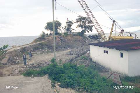 |
|
Type:
|
Mound |
|
Altitude:
|
0 m |
|
Region:
|
Black Sea |
|
Province:
|
Sinop |
|
District:
|
Gerze |
|
Village:
|
Merkez |
|
Investigation Method:
|
Survey |
|
Period:
|
|
|
|
|
 |
|
| It lies under the lighthouse on the Kösk Cape; immediate north of Gerze District; southeast of Sinop Province. It was discovered during the Sinop Survey conducted by M.A. Isin. It was revisited during a survey conducted by S. Dönmez in 1998. It stands on a natural hill. It measures 7-8 m in height and 50x30 m in dimensions. Materials belonging to the Chalcolithic Age; the EBA and the Early Hittite Period were collected from the surface. It has been damaged by the modern buildings. It takes place in the registered archaeological sites list prepared by Ministry of Culture and Tourism. |
| Location: |
| Geography and Environment: |
| History: |
| Research and Excavation: |
| Stratigraphy: |
| Small Finds: |
| Remains: |
| Interpretation and Dating: |