|
©The Archaeological Settlements of Turkey - TAY Project
|
|
|
|
|
|
Konya Höyük (East) |
|
|
For site maps and drawings please click on the picture...  |
For photographs please click on the photo... 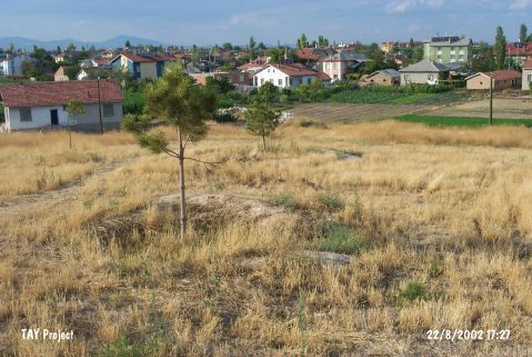 |
|
Type:
|
Mound |
|
Altitude:
|
1045 m |
|
Region:
|
Central Anatolia |
|
Province:
|
Konya |
|
District:
|
Karatay |
|
Village:
|
Merkez |
|
Investigation Method:
|
Survey |
|
Period:
|
|
|
|
|
  |
|
| It is located at Bayirucu Street in Saraçoglu Quarter of Karatay District of Konya Province. The mound which is surrounded by the modern settlement lies 500 m north of Konya-Karaman motorway and has a dimension of 100x75x5 m. The mound has different settlements from EBA to Byzantine Period and its north; east parts are destructed. The site was discovered by J. Mellaart and named as Saraçoglu Höyük by H. Bahar. It is reported by Bahar in his 2002 survey that the destruction occurred by afforestation and water canals. |
| Location: |
| Geography and Environment: |
| History: |
| Research and Excavation: |
| Stratigraphy: |
| Small Finds: |
| Remains: |
| Interpretation and Dating: |

