|
©The Archaeological Settlements of Turkey - TAY Project
|
|
|
|
|
|
Kocahidir Mevkii |
|
|
For site maps and drawings please click on the picture... 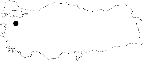 |
For photographs please click on the photo...  |
|
Type:
|
Single Findspot |
|
Altitude:
|
m |
|
Region:
|
Marmara |
|
Province:
|
Balikesir |
|
District:
|
Merkez |
|
Village:
|
Balikli |
|
Investigation Method:
|
Survey |
|
Period:
|
|
|
|
|
 |
|
| Location: This site is in the province of Balikesir; east of the city; 3 km northeast of the village of Balikli; on route to the village of Hotoslar. Its survey code is K 9 / 4. |
| Geography and Environment: The basin-like Balikesir Plain is surrounded by mountains. The thick deposition of erosional fill on the floor of this basin makes it difficult to locate Palaeolithic sites. |
| History: |
| Research and Excavation: This site was discovered by Mehmet Özdogan during his 1977 survey of the Balikesir province. |
| Stratigraphy: |
| Small Finds: Özdogan does not provide information on the Palaeolithic assemblage he found during his survey of this region. |
| Remains: |
| Interpretation and Dating: |