|
©The Archaeological Settlements of Turkey - TAY Project
|
|
|
|
|
|
KM 88 Çoçelli |
|
|
For site maps and drawings please click on the picture...  |
For photographs please click on the photo... 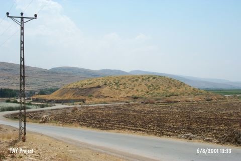 |
|
Type:
|
Mound |
|
Altitude:
|
560 m |
|
Region:
|
Mediterranean |
|
Province:
|
Kahramanmaras |
|
District:
|
Pazarcik |
|
Village:
|
Çöçelli |
|
Investigation Method:
|
Survey |
|
Period:
|
Late |
|
|
|
 |
|
| The mound; discovered by E. Carter during the Kahramanmaras Archaeological Survey Project; lies in the territory of Çöçelli Village; southwest of Pazarcik District of Kahramanmaras Province. It is intensely ruined both by the construction of a highway and illicit digging. Sherds in plain ware with smoothed surface suggest Late Chalcolithic Age pottery interrelated with Amuq F and G phases. Although the finds lack Uruk wares or bevelled rim bowls; earlier occupation levels are thought to be existent. One important item among the finds is a small sized seal. |
| Location: |
| Geography and Environment: |
| History: |
| Research and Excavation: |
| Stratigraphy: |
| Small Finds: |
| Remains: |
| Interpretation and Dating: |