|
©The Archaeological Settlements of Turkey - TAY Project
|
|
|
|
|
|
Killigin Magarasi |
|
|
For site maps and drawings please click on the picture... 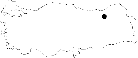 |
For photographs please click on the photo...  |
|
Type:
|
Cave |
|
Altitude:
|
2000 m |
|
Region:
|
Black Sea |
|
Province:
|
Bayburt |
|
District:
|
Merkez |
|
Village:
|
Erenli |
|
Investigation Method:
|
Survey |
|
Period:
|
EP |
|
|
|
 |
|
| Location: This cave-site is 3.5 km; as the crow flies; from the city of Bayburt; 2.1 km northeast of the village of Erenli (Duduzar). |
| Geography and Environment: The cave is located on the southwestern side of the Killigin Ridge; which is at an altitude of 1;191 m at its highest point. Rainwater has eroded this massive ridge. The entrance of the cave; carved out by water; faces south. The cave is 9.2 m deep and 1.9 m high inside while the entrance is 1.71 m high and 6.45 m wide at the base. |
| History: |
| Research and Excavation: The site was coincidentally discovered by a team of geologists from Karadeniz (Black Sea) Technical University who were geologically surveying the Black Sea Region. The collection of the artifacts was not systematic. |
| Stratigraphy: |
| Small Finds: Some basalt microliths were found at the mouth of the cave while other chipped stones also made from basalt were collected from the nearby slopes [Gündüzalp 1986:53-54]. Although no date has been published; the descriptions of these tools suggest an Epipalaeolithic date. |
| Remains: |
| Interpretation and Dating: |