|
©The Archaeological Settlements of Turkey - TAY Project
|
|
|
|
|
|
Kayaardi Tepesi |
|
|
For site maps and drawings please click on the picture...  |
For photographs please click on the photo... 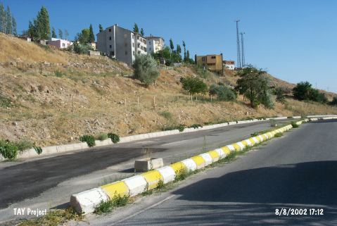 |
|
Type:
|
Artifact Scatter |
|
Altitude:
|
1330 m |
|
Region:
|
Central Anatolia |
|
Province:
|
Nigde |
|
District:
|
Merkez |
|
Village:
|
Merkez |
|
Investigation Method:
|
Survey |
|
Period:
|
OP |
|
|
|
 |
|
| Location: The site lies at Kayaardi Mevkii; on a terrace 2.4 km northwest of the city of Nigde; in an area that overlooks the city. It is also known as Kisla Kadarak. |
| Geography and Environment: Mount Kayaardi is 1 km long; flat and rocky. In 1967 when Todd was researching the area; he noted that Mount Kayaardi in entirety would very shortly be completely covered by modern development. The road that goes from Nigde to Yesilburç is built along side the water pipelines. Finds were found scattered on and around the rocky hill. The thickness of the depositional fill is not known. In many places; bedrock is still at the surface. |
| History: |
| Research and Excavation: The site was discovered by Güner Soylu. In addition to Soylu; Todd conducted a surface survey at the site in 1966. |
| Stratigraphy: |
| Small Finds: Although the number of tools found in the Kisla Kadarak Region is not reported; three have been described in depth. We are informed that one is a double end scraper. The tool has clearly apparent side notches resulting from utilization. Soylu; who assigns two obsidian handaxe-like tools to the Later Middle Palaeolithic Period; believes that they indicate that the province of Nigde is especially rich in Palaeolithic sites. |
| Remains: |
| Interpretation and Dating: |