|
©The Archaeological Settlements of Turkey - TAY Project
|
|
|
|
|
|
Anep Sirti |
|
|
For site maps and drawings please click on the picture... 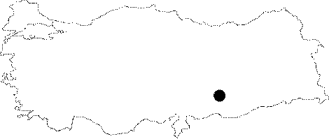 |
For photographs please click on the photo...  |
|
Type:
|
Habitation Site / Workshop |
|
Altitude:
|
m |
|
Region:
|
Southeastern Anatolia |
|
Province:
|
Adiyaman |
|
District:
|
Kahta |
|
Village:
|
Dardagan |
|
Investigation Method:
|
Survey |
|
Period:
|
ÜP |
|
|
|
 |
|
| Location: This open-air habitation site has recently been flooded by the Atatürk Dam Lake. It was east of the city of Adiyaman and close to the district of Kahta; situated on the flanks of the Anep Ridge southwest of the village of Dardagan; facing the Euphrates. Its survey code is T 52 / 16. |
| Geography and Environment: The high plateau that the villages of Dardagan; Keferkurus and the Anep Ridge lie on is cut by seasonal streams which have formed steep incising gorges. |
| History: |
| Research and Excavation: A survey of the Anatolian Lower Euphrates Basin was conducted in 1977 by a team led by Özdogan from the University of Istanbul; Faculty of Letters; Prehistory Section. The survey yielded a large amount of Palaeolithic tools and debitage products. Collections on the slopes of the Anep Ridge facing the Anep Stream were especially fruitful. |
| Stratigraphy: |
| Small Finds: Several flakes with retouched edges; a scraper and several drills on micro-flakes were found. The researcher assigns these finds to the Upper Palaeolithic Period. |
| Remains: |
| Interpretation and Dating: |