|
©The Archaeological Settlements of Turkey - TAY Project
|
|
|
|
|
|
Kelbestepe |
|
|
For site maps and drawings please click on the picture...  |
For photographs please click on the photo... 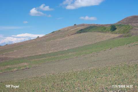 |
|
Type:
|
Mound |
|
Altitude:
|
105 m |
|
Region:
|
Black Sea |
|
Province:
|
Samsun |
|
District:
|
Bafra |
|
Village:
|
Dededagi |
|
Investigation Method:
|
Survey |
|
Period:
|
|
|
|
|
 |
|
| It lies west of Dededagi Village; south of Bafra District of Samsun Province. It is a shallow mound and west of it flows a stream. It was discovered by U.B. Alkim and dated to EBA. It takes place in the registered archaeological sites list prepared by Ministry of Culture and Tourism. The mound appears in the Samsun Culture Inventory which was achieved after the surveys organized by the Samsun Special Provincial Administration Directorship of Development and Construction in 2009.Its western slope lies down straight to the valley while its northern and southern slopes are more flat. It is about 200x80 m in dimension and 15 m in height. Based on the potsherds recovered from the surface; the mound is dated to EBA, MBA and Roman and Late Roman periods. To the south direction, there is also a tumulus which is 30-40 m away from the top of the mound. |
| Location: |
| Geography and Environment: |
| History: |
| Research and Excavation: |
| Stratigraphy: |
| Small Finds: |
| Remains: |
| Interpretation and Dating: |