|
©The Archaeological Settlements of Turkey - TAY Project
|
|
|
|
|
|
Kefken - Cebeci Yöresi |
|
|
For site maps and drawings please click on the picture... 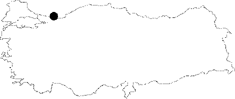 |
For photographs please click on the photo...  |
|
Type:
|
Habitation Site / Workshop |
|
Altitude:
|
0 m |
|
Region:
|
Marmara |
|
Province:
|
Kocaeli |
|
District:
|
Kandira |
|
Village:
|
Cebeci |
|
Investigation Method:
|
Survey |
|
Period:
|
OP ÜP AP |
|
|
|
 |
|
| Location: This open-air site is north of the city of Izmit; on the Black Sea coast; near the town of Kandira. It lies in the village of Kefken (old Mansuriye) and in the area east of it; between this village and the village of Cebeci. |
| Geography and Environment: In antiquity this town was called "Kafganos"; literally meaning "stony area" [Bijiskyan 1969:19]. Beyond the beach approximately 1.5 km from Kefken is a bay where small boats can harbor. The rivers of the Kocaeli Peninsula on which the villages of Kefken and Cebeci lie are oriented north or northwest. The topography of the peninsula is hilly but includes plateau areas and valleys. There are also a few forested areas nearby. |
| History: |
| Research and Excavation: The site was discovered during a weekend excursion of students and faculty from the University of Istanbul; Faculty of Letters; Prehistory Section. Many of the Palaeolithic finds in this region were discovered by a local amateur surveyor Mimar Faruk Ertunç. Scientific surface surveys in the area were begun in 1984 by Mehmet Celal Özdogan; member of the faculty of the Prehistory Section of the University of Istanbul. The village of Kefken; the hill south of the village; the western flat plain near Sari Burun Point; the area east of the village and west of the military zone in the Asagi Kovanagzi Bay; the region east of the bay; the forested area between the point of the peninsula; Vizne Point; the village of Gürgenpinar and the area in and around the village of Cebeci yielded artifacts during Özdogan's 1984 survey. Özdogan also discovered a flintstone workshop on Kefken Point [Özdogan 1986a:411]. The surface survey directed by M. Özdogan continued in 1986. In the two survey seasons; a total of 5 artifact scatters; which have been assigned to the end of the Lower Palaeolithic and to the Middle Palaeolithic periods; were discovered. Özdogan's map in his 1986 publication shows new artifact scatters at the tip of Vizne Point north of the Asagi Kovanagzi Bay; east of Kefken on the Cebeci Kumlugu Beach and southeast of this in the Kurt Yeri vicinity [Özdogan 1988a:158; map in fig. 1]. These artifact scatters indicate how rich this area is in Palaeolithic finds. Ertunç mentions that there were Palaeolithic finds along the sides of the river. More research needs to be conducted on the hills beyond the village. |
| Stratigraphy: |
| Small Finds: Chipped stone tools found before 1980 were collected around the village and in the forested area between Vizne Burnu Point and the village of Gürgenpinar. The finds include some Middle Palaeolithic points. Özdogan reports that he found another Lower Palaeolithic activity area east of Kefken in Asagi Kovanagzi [Özdogan 1986a:411]. Although he does mention that he came across Lower Palaeolithic tools on Cebeci Ridge; he has not published the typological characteristics of these tools [ibid]. Faruk Ertunç reports that the most well-made artifacts are found in the region between the village of Cebeci and the pink rocks; which are located between the villages of Kefken and Cebeci. He informed us that he found a carefully made 15 cm long elliptically shaped biface near the village of Gürgenpinar (personal communication). |
| Remains: |
| Interpretation and Dating: |