|
©The Archaeological Settlements of Turkey - TAY Project
|
|
|
|
|
|
Keçi Türbesi |
|
|
For site maps and drawings please click on the picture...  |
For photographs please click on the photo... 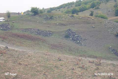 |
|
Type:
|
Mound and Cemetery |
|
Altitude:
|
1090 m |
|
Region:
|
Black Sea |
|
Province:
|
Sinop |
|
District:
|
Gerze |
|
Village:
|
Hidirli |
|
Investigation Method:
|
Survey |
|
Period:
|
|
|
|
|
 |
|
| It lies to the northeast of Taspinar stream; 8 km far from the exit of Hidirli Village; east-southeast of Hidirli; southwest of Gerze District; south of Sinop Province. It was first introduced by M.A. Isin; and re-investigated by S. Dönmez in 1998. According to Isin; it measures 7 m in height and 70x50 m in dimensions whereas it measures 6 m in height and 80x60 m in dimensions for S. Dönmez. To the southeast lies a cemetery along the stream. Between 1973 and 1980; metal objects and terra cotta items dating from the EBA and MBA were brought to the Museum of Sinop from the cemetery. In 1987 M.A. Isin who conducted a survey on both the cemetery and the mound collected pottery of the Chalcolithic Age and the EBA from the surface while the survey conducted by S. Dönmez in 1998 yielded finds belonging to the EBA; the MBA and the Roman Period. It takes place in the registered archaeological sites list prepared by Ministry of Culture and Tourism. |
| Location: |
| Geography and Environment: |
| History: |
| Research and Excavation: |
| Stratigraphy: |
| Small Finds: |
| Remains: |
| Interpretation and Dating: |