|
©The Archaeological Settlements of Turkey - TAY Project
|
|
|
|
|
|
Ambarci Eskiköy Sirtlari |
|
|
For site maps and drawings please click on the picture...  |
For photographs please click on the photo... 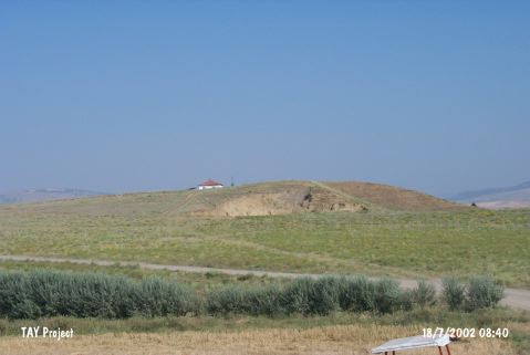 |
|
Type:
|
Upland Settlement |
|
Altitude:
|
585 m |
|
Region:
|
Central Anatolia |
|
Province:
|
Çorum |
|
District:
|
Ugurludag |
|
Village:
|
Ambarci |
|
Investigation Method:
|
Survey |
|
Period:
|
|
|
|
|
 |
|
| It lies north of the road after crossing Kizilirmak River; 1.8 km north of Ambarci Village; west of Çorum Province. It was discovered in 1996 during a survey conducted under T. Sipahi and T. Yildirim in the Çorum region. It stands on a natural sand hill. It has been partly damaged due to the sand dragging to meet the raw material requirements of a brick factory located nearby. Clefts caused by this damage yielded sherds of EBA. It is claimed to be an insignificant and poor settlement. |
| Location: |
| Geography and Environment: |
| History: |
| Research and Excavation: |
| Stratigraphy: |
| Small Finds: |
| Remains: |
| Interpretation and Dating: |